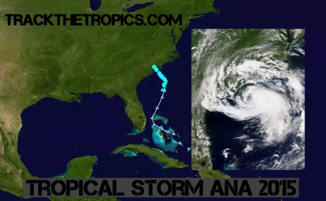
Tropical Storm Ana historical Information:
On May 3, the National Hurricane Center began highlighting the expected formation of a non-tropical area of low pressure north of the Bahamas. Early on May 6, a weak surface low was associated with a broad upper trough as disorganized shower and thunderstorm activity extended across Florida, The Bahamas, and adjacent waters. Steady development occurred over the warm waters of the Gulf Stream, and by 03:00 UTC on May 8, the disturbance acquired sufficient organization to be declared Subtropical Storm Ana. By May 9, Ana became fully tropical.
|
|
|||||||||||||||||||||||||||||||
|
24 Visitors Tracking The Tropics! 0 Active Threats To TrackSUPPORT TRACK THE TROPICS Track The Tropics has been the #1 source to track the tropics 24/7 since 2013! The main goal of the site is to bring all of the important links and graphics to ONE PLACE so you can keep up to date on any threats to land during the Atlantic Hurricane Season! Hurricane Season 2025 in the Atlantic starts on June 1st and ends on November 30th. Do you love Spaghetti Models? Well you've come to the right place!! Remember when you're preparing for a storm: Run from the water; hide from the wind! Tropical Atlantic Weather ResourcesNOAA National Hurricane Center International Meteorology Database FSU Tropical Cyclone Track Probabilities Brian McNoldy Atlantic Headquarters Brian McNoldy Tropical Satellite Sectors Brian McNoldy Infrared Hovmoller Brian McNoldy Past TC Radar Loops Weather Nerds Models/ TC Guidance/ Sat Albany GFS/ EURO Models/ Ensembles Albany Tropical Cyclone Guidance Albany Tropical Atlantic Model Maps Pivotal Weather Model Guidance UKMet Model Guidance/ Analysis/ Sat ECMWF (EURO) Model Guidance/ Analysis College of DuPage Model Guidance NOAA NCEP/EMC Cyclogenesis Tracking University of Miami Ocean Heat Content COLA Max Potential Hurricane Intensity Colorado State RAMMB TC Tracking Colorado State RAMMB Tropical Floaters Colorado State RAMMB GOES-16 Viewer ASCAT Ocean Surface Winds METOP-A ASCAT Ocean Surface Winds METOP-B Michael Ventrice Waves / MJO Maps TropicalAtlantic.com Analysis / Recon NCAR/RAL Tropical Cyclone Guidance Current UTC Time Main Menu
Learn and Prepare for HurricanesCyclone Archive Pages and LinksLatest Posts on the LHC Blog
Saffir-Simpson Hurricane Scale
Hurricane Season 101The official Atlantic Basin Hurricane Season runs from June 1st to November 30th. A tropical cyclone is a warm-core, low pressure system without any “front” attached. It develops over tropical or subtropical waters, and has an organized circulation. Depending upon location, tropical cyclones have different names around the world. The Tropical Cyclones we track in the Atlantic basin are called Tropical Depressions, Tropical Storms and Hurricanes! Atlantic Basin Tropical Cyclones are classified as follows: Tropical Depression: Organized system of clouds and thunderstorms with defined surface circulation and max sustained winds of 38 mph or less. Tropical Storm: Organized system of strong thunderstorms with a defined surface circulation and maximum sustained winds of 39-73 mph. Hurricane: Intense tropical weather system of strong thunderstorms with a well-defined surface circulation. A Hurricane has max sustained winds of 74 mph or higher! The difference between Tropical Storm and Hurricane Watches, Warnings, Advisories and OutlooksWarnings:Listen closely to instructions from local officials on TV, radio, cell phones or other computers for instructions from local officials.Evacuate immediately if told to do so.
Please note that hurricane and tropical storm watches and warnings for winds on land as well as storm surge watches and warnings can be issued for storms that the NWS believes will become tropical cyclones but have not yet attained all of the characteristics of a tropical cyclone (i.e., a closed low-level circulation, sustained thunderstorm activity, etc.). In these cases, the forecast conditions on land warrant alerting the public. These storms are referred to as “potential tropical cyclones” by the NWS. Watches: Listen closely to instructions from local officials on TV, radio, cell phones or other computers for instructions from local officials. Evacuate if told to do so.
Advisories:
Outlooks:
Be sure to read up on tons of more information on Hurricane knowledge, preparedness, statistics and history under the menu on the left hand side of the page! TrackTheTropics Resource LinksThank you to all of these websites for information and graphics we use on this website. Please be sure to visit these sites for tons of more tools on tracking the Tropics!
National Hurricane Center / Tropical Tidbits / CIMSS Tropical Group / Tropical Atlantic / NASA Earth / Intellicast / NOAA WPC / UWM Hurricane Models / South Florida Hurricane Models / Accuweather / Weather.com / FSU TC Models / NOAA TC Probability / NCEP/EMC Cyclogenesis Tracking / NOAA GOES East Imagery / Unisys Hurricane Data / PSU Tropical Group / Weather Underground / NOAA NESDIS / NRL Tropical Cyclone Page / Storm Surfing / GMU WxMaps CONUS Hurricane Strikes1950-2017
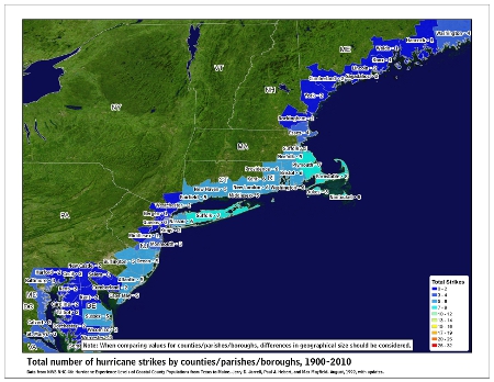
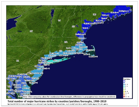
![[Map of 1950-2017 CONUS Hurricane Strikes]](http://www.nhc.noaa.gov/climo/images/conus_strikes_sm.jpg) Total Hurricane Strikes 1900-2010 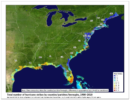 Total MAJOR Hurricane Strikes 1900-2010
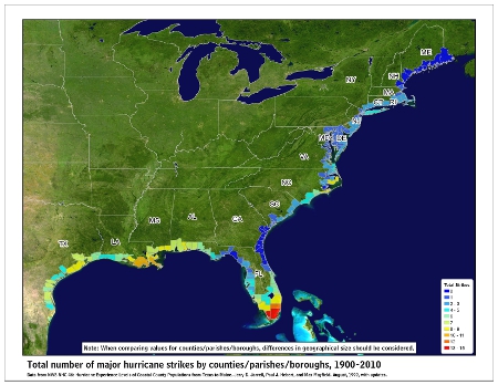 Western Gulf Hurricane Strikes
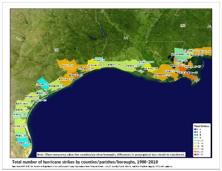 Western Gulf MAJOR Hurricane Strikes
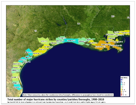 Eastern Gulf Hurricane Strikes
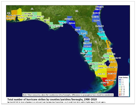 Eastern Gulf MAJOR Hurricane Strikes
 SE Coast Hurricane Strikes
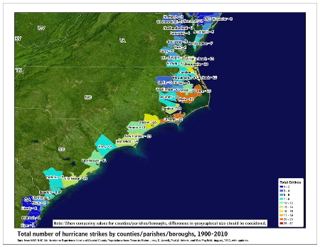 SE Coast MAJOR Hurricane Strikes
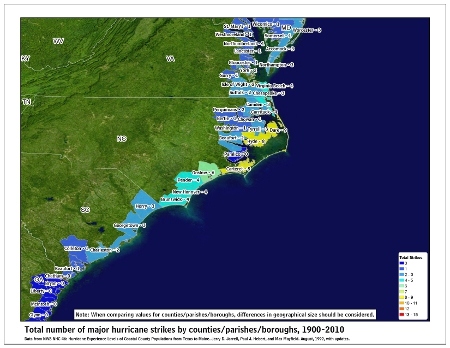 NE Coast Hurricane Strikes
 NE Coast MAJOR Hurricane Strikes
 |
Tropical Storm Ana 2015 ArchiveMay 10th, 2015 | Tags: 2015, Ana, Hurricane Season, Tropical Storm, Tropics | Category: Hurricane Season News |
||||||||||||||||||||||||||||||
|
DISCLAIMER: This website, TrackTheTropics.com, is for general information only and not to be used for any official forecast. This site is made to provide as many useful links and information possible for hurricane tracking and knowledge. Please first consult the NWS and NHC before making decisions on any kind of weather event. We are also not responsible for inaccurate maps or data on this page. Powered by WordPress & Atahualpa 74 queries. 1.194 seconds. |
|||||||||||||||||||||||||||||||
 DONATE