
SHOW ME SOME LOVE AND SUPPORT
Website: TrackTheTropics.com/DONATE
Venmo: @TrackTheTropicsLouisiana
Cash App: Cash.App/$TrackTheTropics
Subscribe: FB.com/TrackTheTropics
Website: TrackTheTropics.com/DONATE
Venmo: @TrackTheTropicsLouisiana
Cash App: Cash.App/$TrackTheTropics
Subscribe: FB.com/TrackTheTropics

Earn CASH Back On Gas $$$$ 
Shop Store For Essentials
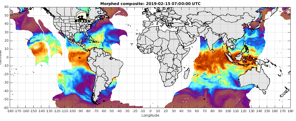
Sea surface temperature (SST) is an important factor in hurricane dynamics. SST is measured over large portions of the ocean by satellites. Sea surface temperatures are generally warmer at low latitudes and colder at high latitudes but SST will vary with the seasons and with surface ocean currents. For forecasting hurricanes, more detailed maps of SST are produced for areas of hurricane formation. SST must be 82 degrees Fahrenheit (F) or warmer for tropical cyclone formation and sustenance.

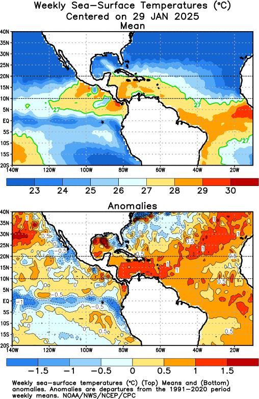
 For hurricane forecasting, it can also be very useful to look at the SST anomalies. A SST anomaly is the difference in the current SST measurement from the long-term average temperature for a given month, in a given place (the climatology). Positive temperature anomalies indicate that the water is warmer than usual and negative anomalies indicate that the water is cooler than usual.

Global Surface Sea Temperature Animation - Last 72 Hours
Gulf of Mexico Sea Temperatures
Atlantic Sea Surface Temps
For hurricane forecasting, it can also be very useful to look at the SST anomalies. A SST anomaly is the difference in the current SST measurement from the long-term average temperature for a given month, in a given place (the climatology). Positive temperature anomalies indicate that the water is warmer than usual and negative anomalies indicate that the water is cooler than usual.
Atlantic Sea Temperature Anomalies
Weekly Sea Surface Temperatures