SUPPORT TRACK THE TROPICS
Over the last decade plus if you appreciate the information and tracking I provide during the season along with this website which donations help keep it running please consider a one time... recurring or yearly donation if you are able to help me out...
Venmo: @TrackTheTropicsLouisiana
Website: TrackTheTropics.com/DONATE
Venmo: @TrackTheTropicsLouisiana
Website: TrackTheTropics.com/DONATE
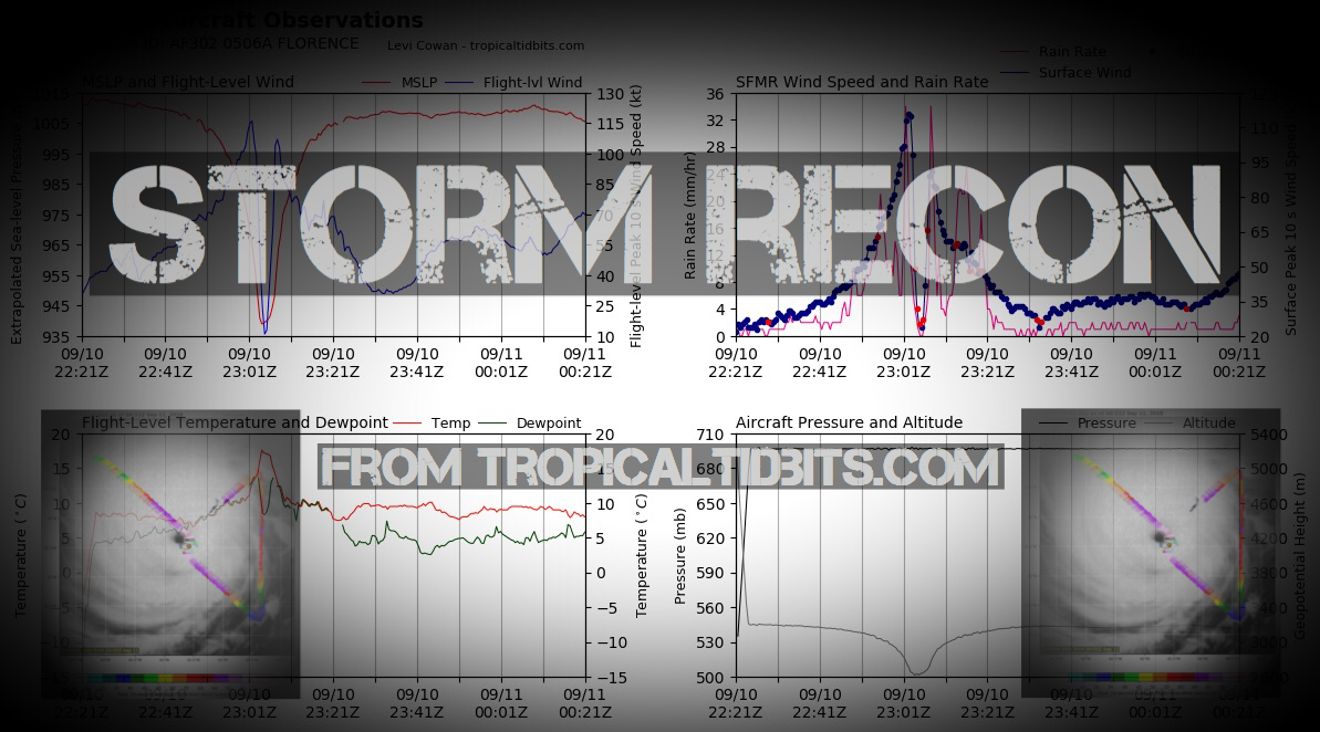
Storm Recon
CONUS Hurricane Strikes
![[Map of 1950-2017 CONUS Hurricane Strikes]](http://www.nhc.noaa.gov/climo/images/conus_strikes.jpg)
Total Hurricane Strikes 1900-2010

Total MAJOR Hurricane Strikes 1900-2010

Western Gulf Hurricane Strikes

Western Gulf MAJOR Hurricane Strikes

Eastern Gulf Hurricane Strikes

Eastern Gulf MAJOR Hurricane Strikes

SE Coast Hurricane Strikes

SE Coast MAJOR Hurricane Strikes

NE Coast Hurricane Strikes

NE Coast MAJOR Hurricane Strikes

Projected Path with Watches and Warnings

NOAA NESDIS Floaters


WeatherNerds.org Floaters

|

|

|

|
Additional Projected Path Swath


Windshear Around Storm


Most Likely Arrival Time of Tropical Storm Force Winds

Dry Air/ Water Vapor Around Storm
Intensity Forecasts

Most Reasonable Arrival Time of Tropical Storm Force Winds

Water Temps around Storm

Model Tracks


Hurricane Force Wind Probabilities

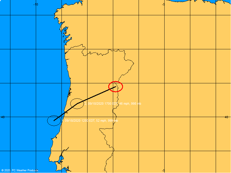
Past Track History

GFS / Canadian Ensemble Tracks

Tropical Storm Force Wind Probabilities

Top Analog Tracks

EURO Ensemble Tracks
Surface Wind Field

EPS Ensemble Tracks

Cumulative Wind History

Windfield

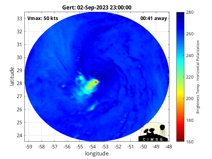
Microwave Imagery
2 Day Tropical Weather Outlook

7 Day Tropical Weather Outlook
