0 Active Threats To Track
Venmo: @TrackTheTropicsLouisiana
Website: TrackTheTropics.com/DONATE
Current Tropics Activity (hidden template)
| U.S. THREAT | Active Storm |
| ALERT | Active Storm |
| ALERT | Active Invest 90L |
| WATCHING | 1 Area Of Interest |
Track The Tropics is the #1 source to track the tropics 24/7! Since 2013 the main goal of the site is to bring all of the important links and graphics to ONE PLACE so you can keep up to date on any threats to land during the Atlantic Hurricane Season! Hurricane Season 2025 in the Atlantic starts on June 1st and ends on November 30th. Do you love Spaghetti Models? Well you've come to the right place!! Remember when you're preparing for a storm: Run from the water; hide from the wind!
Tropical Atlantic Weather Resources
- NOAA National Hurricane Center
- International Meteorology Database
- FSU Tropical Cyclone Track Probabilities
- Brian McNoldy Atlantic Headquarters
- Brian McNoldy Tropical Satellite Sectors
- Brian McNoldy Infrared Hovmoller
- Brian McNoldy Past TC Radar Loops
- Weather Nerds Models/ TC Guidance/ Sat
- Twister Data Model Guidance
- NOAA Tropical Cyclone Tracks
- Albany GFS/ EURO Models/ Ensembles
- Albany Tropical Cyclone Guidance
- Albany Tropical Atlantic Model Maps
- Pivotal Weather Model Guidance
- Weather Online Model Guidance
- UKMet Model Guidance/ Analysis/ Sat
- ECMWF (EURO) Model Guidance/ Analysis
- FSU Tropical Model Outputs
- FSU Tropical Cyclone Genesis
- Penn State Tropical E-Wall
- NOAA HFIP Ruc Models
- Navy NRL TC Page
- College of DuPage Model Guidance
- WXCharts Model Guidance
- NOAA NHC Analysis Tools
- NOAA NHC ATCF Directory
- NOAA NCEP/EMC Cyclogenesis Tracking
- NOAA NCEP/EMC HWRF Model
- NOAA HFIP Model Products
- University of Miami Ocean Heat Content
- COLA Max Potential Hurricane Intensity
- Colorado State RAMMB TC Tracking
- Colorado State RAMMB Tropical Floaters
- Colorado State RAMMB GOES-16 Viewer
- NOAA NESDIS GOES Satellite
- ASCAT Ocean Surface Winds METOP-A
- ASCAT Ocean Surface Winds METOP-B
- Michael Ventrice Waves / MJO Maps
- TropicalAtlantic.com Analysis / Recon
- NCAR/RAL Tropical Cyclone Guidance
- CyclonicWX Tropical Resources
Main Menu
- 2023 Atlantic Hurricane Season Main Page
- Official Atlantic Tracking Chart
- Support Track The Tropics!
- Tropical Weather Outlook
- Interactive Tracking Map
- Live Current and Future Winds
- Gulf / East Coast and Atlantic Satellite
- Africa / East Atlantic Satellite Loops
- Gulf of Mexico and East Coast Radar
- Current Tropical Surface Analysis Maps
- Future Tropical Surface Analysis Maps
- Sea Surface Temperatures (SSTs)
- Atlantic Wind Shear
- Current Wind Direction Steering
- Precipitation Totals Forecasts
- Saharan Air Layer (SAL) Tracking
- MJO Model Forecasts
- El Niño & La Niña Status and Forecasts
- Real Time Buoy and Oil Rig Data
- Real Time Storm Surge Maps and Info
- Hurricane Season News / Blog
- 2018 – 2023 Hurricane Season Names
- 2019 Hurricane Season Storms
- Important Weather Links
Learn and Prepare for Hurricanes
Cyclone Archive Pages and Links
Latest Posts on the LHC Blog
| Category | Wind Speed (mph) | Storm Surge (ft) |
| 5 | ≥157 | >18 |
| 4 | 130–156 | 13–18 |
| 3 | 111–129 | 9–12 |
| 2 | 96–110 | 6–8 |
| 1 | 74–95 | 4–5 |
| Additional Classifications | ||
| Tropical Storm | 39–73 | 0–3 |
| Tropical Depression | 0–38 | 0 |
Hurricane Season 101
The official Atlantic Basin Hurricane Season runs from June 1st to November 30th. A tropical cyclone is a warm-core, low pressure system without any “front” attached. It develops over tropical or subtropical waters, and has an organized circulation. Depending upon location, tropical cyclones have different names around the world. The Tropical Cyclones we track in the Atlantic basin are called Tropical Depressions, Tropical Storms and Hurricanes! Atlantic Basin Tropical Cyclones are classified as follows: Tropical Depression: Organized system of clouds and thunderstorms with defined surface circulation and max sustained winds of 38 mph or less. Tropical Storm: Organized system of strong thunderstorms with a defined surface circulation and maximum sustained winds of 39-73 mph. Hurricane: Intense tropical weather system of strong thunderstorms with a well-defined surface circulation. A Hurricane has max sustained winds of 74 mph or higher!The difference between Tropical Storm and Hurricane Watches, Warnings, Advisories and Outlooks
Warnings: Listen closely to instructions from local officials on TV, radio, cell phones or other computers for instructions from local officials. Evacuate immediately if told to do so.- Storm Surge Warning: There is a danger of life-threatening inundation from rising water moving inland from the shoreline somewhere within the specified area. This is generally within 36 hours. If you are under a storm surge warning, check for evacuation orders from your local officials.
- Hurricane Warning: Hurricane conditions (sustained winds of 74 mph or greater) are expected somewhere within the specified area. NHC issues a hurricane warning 36 hours in advance of tropical storm-force winds to give you time to complete your preparations. All preparations should be complete. Evacuate immediately if so ordered.
- Tropical Storm Warning: Tropical storm conditions (sustained winds of 39 to 73 mph) are expected within your area within 36 hours.
- Extreme Wind Warning: Extreme sustained winds of a major hurricane (115 mph or greater), usually associated with the eyewall, are expected to begin within an hour. Take immediate shelter in the interior portion of a well-built structure.
Watches: Listen closely to instructions from local officials on TV, radio, cell phones or other computers for instructions from local officials. Evacuate if told to do so.
- Storm Surge Watch: Storm here is a possibility of life-threatening inundation from rising water moving inland from the shoreline somewhere within the specified area, generally within 48 hours. If you are under a storm surge watch, check for evacuation orders from your local officials.
- Hurricane Watch: Huriricane conditions (sustained winds of 74 mph or greater) are possible within your area. Because it may not be safe to prepare for a hurricane once winds reach tropical storm force, The NHC issues hurricane watches 48 hours before it anticipates tropical storm-force winds.
- Tropical Storm Watch: Tropical storm conditions (sustained winds of 39 to 73 mph) are possible within the specified area within 48 hours.
- Tropical Cyclone Public Advisory:The Tropical Cyclone Public Advisory contains a list of all current coastal watches and warnings associated with an ongoing or potential tropical cyclone, a post-tropical cyclone, or a subtropical cyclone. It also provides the cyclone position, maximum sustained winds, current motion, and a description of the hazards associated with the storm.
- Tropical Cyclone Track Forecast Cone:This graphic shows areas under tropical storm and hurricane watches and warnings, the current position of the center of the storm, and its predicted track. Forecast uncertainty is conveyed on the graphic by a “cone” (white and stippled areas) drawn such that the center of the storm will remain within the cone about 60 to 70 percent of the time. Remember, the effects of a tropical cyclone can span hundreds of miles. Areas well outside of the cone often experience hazards such as tornadoes or inland flooding from heavy rain.
- Tropical Weather Outlook:The Tropical Weather Outlook is a discussion of significant areas of disturbed weather and their potential for development during the next 5 days. The Outlook includes a categorical forecast of the probability of tropical cyclone formation during the first 48 hours and during the entire 5-day forecast period. You can also find graphical versions of the 2-day and 5-day Outlook here
TrackTheTropics Resource Links
- National Hurricane Center
- Tropical Tidbits
- CIMSS Tropical Group
- Tropical Atlantic
- NASA Earth
- Intellicast
- NOAA WPC
- UWM Hurricane Models
- South Florida Hurricane Models
- Accuweather
- Weather.com
- FSU TC Models
- NOAA TC Probability
- NCEP/EMC Cyclogenesis Tracking
- NOAA GOES East Imagery
- Unisys Hurricane Data
- PSU Tropical Group
- Weather Underground
- NOAA NESDIS
- NRL Tropical Cyclone Page
- Storm Surfing
- GMU WxMaps
CONUS Hurricane Strikes
![[Map of 1950-2017 CONUS Hurricane Strikes]](http://www.nhc.noaa.gov/climo/images/conus_strikes_sm.jpg)
Total Hurricane Strikes 1900-2010
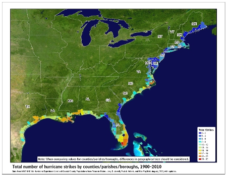
Total MAJOR Hurricane Strikes 1900-2010
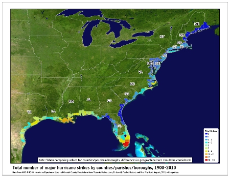
Western Gulf Hurricane Strikes
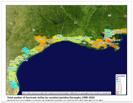
Western Gulf MAJOR Hurricane Strikes
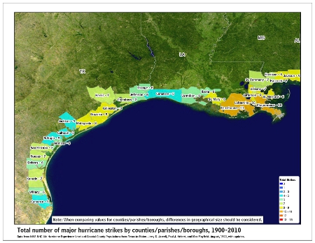
Eastern Gulf Hurricane Strikes
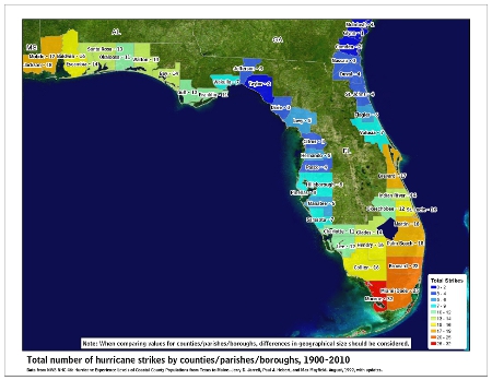
Eastern Gulf MAJOR Hurricane Strikes

SE Coast Hurricane Strikes
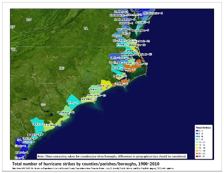
SE Coast MAJOR Hurricane Strikes
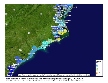
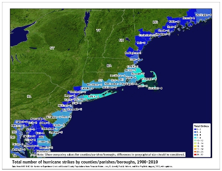
NE Coast Hurricane Strikes
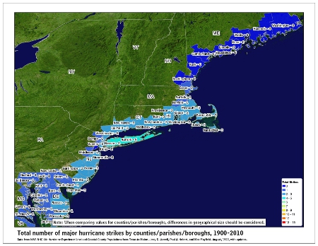
NE Coast MAJOR Hurricane Strikes
Tropical Storm Fay Archive – 2020 Hurricane Season
 Tropical Storm Fay at peak intensity shortly before landfall in New Jersey on July 10 | |
| Meteorological history | |
|---|---|
| Formed | July 9, 2020 (2020-07-09) |
| Remnant low | July 11, 2020 |
| Dissipated | July 12, 2020 (2020-07-12) |
| Tropical storm | |
| 1-minute sustained (SSHWS/NWS) | |
| Highest winds | 60 mph (95 km/h) |
| Lowest pressure | 998 mbar (hPa); 29.47 inHg |
| Overall effects | |
| Fatalities | 6 total |
| Damage | $220 million (2020 USD) |
| Areas affected | Eastern Southeastern United States, East Coast of the United States, Atlantic Canada |
Part of the 2020 Atlantic hurricane season | |
Tropical Storm Fay was the first tropical cyclone to make landfall in the U.S state of New Jersey since Hurricane Irene in 2011. The sixth named storm of the very active 2020 Atlantic hurricane season, Fay was the earliest sixth named storm on record in the basin when it formed on July 9. Fay originated from a surface low that formed over the Northern Gulf of Mexico on July 3 and slowly drifted eastward, before crossing over the Florida Panhandle. The system subsequently drifted across the Southeastern United States as a well-defined low pressure system, before emerging off the coast of North Carolina on July 8. From there, the storm utilized favorable conditions for development, or tropical cyclogenesis, and coalesced into a tropical storm on July 9. The storm intensified, reaching its peak intensity on July 10, with maximum 1-minute sustained winds of 60 mph (97 km/h) and a minimum central pressure of 998 millibars (29.5 inHg). While moving northward, Fay made landfall on New Jersey later that day. After making landfall, the storm quickly lost most of its organization and rapidly transitioned into a post-tropical cyclone over New York on July 11, before being absorbed by a larger extratropical low over Quebec on July 12.
Fay's precursor disturbance was responsible for extensive rainfall and flash flooding in the Southeastern United States, especially within Georgia and South Carolina. After its landfall, Tropical Storm Fay brought high winds and stormy weather to much of the Mid-Atlantic states and the Northeastern United States, with the heaviest rains occurring west of Long Island. Six people were killed by rip currents and flooding related to the storm. Many interstates and other principal highways throughout the Philadelphia and New York City metropolitan areas were flooded and were left impassable, leading to widespread road closures and disruption to commuters. Uprooted trees and damaged power lines from windy conditions caused thousands of power outages in Pennsylvania and New Jersey. Total economic losses from Fay in the United States exceeded US$220 million.
Meteorological history

Tropical storm (39–73 mph, 63–118 km/h)
Category 1 (74–95 mph, 119–153 km/h)
Category 2 (96–110 mph, 154–177 km/h)
Category 3 (111–129 mph, 178–208 km/h)
Category 4 (130–156 mph, 209–251 km/h)
Category 5 (≥157 mph, ≥252 km/h)
Unknown
Fay can first be traced back to a decaying trough of frontal origin, which was drifting across the southeastern United States on July 1–2.[1] A portion of the trough formed into a low pressure system off the coast of Georgia, which would later become Tropical Storm Edouard, and the remaining section of the trough persisted over the northern Gulf of Mexico and proceeded to spawn an elongated region of low atmospheric pressure.[1] By July 4, the National Hurricane Center (NHC) first mentioned the possibility of eventual tropical cyclogenesis from this trough in the northern Gulf of Mexico, which at that time consisted of disorganized convection, or thunderstorms.[2] A smaller-scale low pressure center formed within the disturbance, but before the feature could further consolidate, it moved inland near Panama City, Florida around 06:00 UTC on July 6.[1] Surface and Doppler weather radar observations confirmed the feature had a small 90 nmi radius of 1-minute sustained winds up to 35 mph (56 km/h), characteristic of a tropical cyclone, but was accompanied by a large, disorganized area of thunderstorms and thus, didn't meet the NHC's criteria to be deemed a tropical cyclone.[1] While inland, the NHC assessed a 50% probability that the weather system would become a tropical or subtropical cyclone, which the agency soon raised to a 70% probability.[3][4] The low moved through Georgia and proceeded to turned eastward under the influence of the southern edge of the mid-latitude westerly winds, crossing over southern South Carolina, before emerging into the Western Atlantic on July 8.[1] On July 9, the thunderstorm activity of the low increased as it moved northeastward, parallel to the coast of North Carolina even as the system experienced a sudden slowing in its forward motion.[1]
Late on July 9, United States Air Force hurricane hunters flew into the system and detected a low-level circulation center near the edge of its thunderstorms, which indicated a reformation of the original low-level circulation center, with the development of strong convection just east of Cape Hatteras.[1][5] Based on the organization of the system, and observations of 45 mph (72 km/h) sustained winds, the NHC initiated advisories on Tropical Storm Fay at 21:00 UTC on July 9.[6] The storm was located over the warm waters of the Gulf Stream and in an area of light to moderate wind shear; these environmental factors favored intensification of the tropical cyclone.[5] The elongated circulation of the developing storm was steered generally northward by a ridge over the western Atlantic Ocean and by an approaching trough from the south.[7] On July 10, Fay strengthened throughout the day, reaching its peak intensity, with 1-minute sustained winds of 60 mph (97 km/h) and a minimum central pressure of 998 millibars (29.5 inHg), despite some southwesterly wind shear. This wind shear caused the storm to entrain dry air, which gave it a non-classical tropical cyclone structure.[1][8] At that time, Fay had a small circulation center exposed just east of the Delmarva peninsula, which was rotating around a larger circulation.[9] Around 20:00 UTC on July 10, Fay made landfall just north-northeast of Atlantic City, New Jersey with maximum sustained winds of 50 mph (80 km/h).[1] By that time, the system was already losing some of its tropical characteristics, with rapidly decreasing amounts of thunderstorms near the center and the deepest convection displaced well to the east and southeast of the center.[10] Fay continued weakening as it moved northward through New Jersey, and weakened into a tropical depression as it crossed into southeastern New York.[11] Early on July 11, the system transitioned into a post-tropical cyclone as the center became devoid of deep convection.[12] Afterward, Fay's remnants were drawn into the circulation of an approaching extratropical storm, before being fully absorbed into the approaching system over Quebec on July 12.[13]
Preparations

Upon issuing its first advisory on Fay, the National Hurricane Center (NHC) issued a tropical storm warning from Cape May, New Jersey to Watch Hill, Rhode Island, including Long Island and Block Island.[6] On July 10, the NHC extended the warning southward to Fenwick Island, Delaware, including the Delaware Bay.[14] The National Weather Service issued a flash flood watch for much of the Eastern Shore of Maryland, all of New Jersey, and New York City.[15][16][17] The entirety of Long Island was also placed under a flash flood warning.[18]
United States President Donald Trump's rally in Portsmouth, New Hampshire was delayed. Due to concerns of the COVID-19 pandemic, the rally was supposed to be held outdoors. However, forecasters expected heavy rainfall and gusty winds from Fay or its remnants, which led the Trump campaign to postpone the rally, due to safety precautions.[19]
Lifeguards restricted swimming in three Delaware beaches due to the threat for rip currents.[20] Jersey Shore locals were advised to avoid the coast, due to the threat of high waves, while community leaders began to take precautions to diminish flooding threats, such as lowering water levels in nearby lakes.[21] New York Governor Andrew Cuomo released a statement on July 9, urging New York State residents to stay alert and cautious, due to the impending severe weather conditions, highlighting a significant chance of flash flooding.[22] Residents of New York City were advised by New York City Emergency Management to take emergency precautions and to prepare for power outages and locally strong wind gusts.[23]
Impact

Southeastern United States
The precursor disturbance to Fay moved into the Florida Panhandle and crossed over into Georgia on July 6, delivering heavy rainfall throughout the state and causing widespread flash flooding as far as the Savannah River valley.[24] Augusta, Georgia recorded its wettest day in July on record, with 4.64 inches (118 mm) of rain falling in 24 hours, breaking the record of 4.58 inches (116 mm) that had stood since 1887.[25][24] 7.07 inches (180 mm) of rain fell in 48 hours in Loco.[26] US$4,000 worth of property damage occurred in Ringgold, when a severe thunderstorm generated by the disturbance caused 60 mph (97 km/h) winds in the city, causing trees to become uprooted or topple over onto homes.[27] Many roads in South Carolina were deemed inaccessible and became flooded, while one road became completely washed out.[28] Hunting Island State Park in South Carolina recorded at least 12.75 inches (324 mm) of rain due to the disturbance and had to be closed; over 100 sea turtle nests were also destroyed within the park boundaries.[29][30] Beachgoers on the North Carolina coast observed two waterspouts on July 6, with one of them moving ashore and becoming an EF0 tornado, which lifted an umbrella, although it is not clear as to whether or not this was actually caused by Fay or another approaching extratropical storm from the west.[31][32][33][1]
Northeastern United States
Fay's impacts were felt across a majority of the Northeastern U.S., with widespread rain, flash flooding, and minor wind damage occurring as a result of the storm.[24] Losses from Fay in this region were estimated to be at least US$350 million.[34]
Delaware and Pennsylvania
While Fay was near peak intensity, its rainbands produced gale-force winds along the Delaware coast,[35] with sustained winds of 47 mph (76 km/h) and gusts as high as 57 mph (92 km/h) recorded near Long Neck.[1] Several other Mesonet and DelDOT sites measured tropical storm-force wind gusts along the coastline as well.[36] The storm uprooted trees and knocked down power lines in Long Neck and Nassau.[1] Rainfall in the state reached 6.97 in (177 mm) near Lewes.[1] Heavy rainfall caused flooding in Sussex County, reaching depths of 1 to 2.5 ft (0.30 to 0.76 m) in Bethany Beach.[37] Floodwaters covered portions of DE 1, including the area just south of the Indian River Inlet Bridge. The intersection of DE 1 and DE 54 in Fenwick Island was flooded, where a vehicle knocked down a pedestrian signal pole at the intersection.[38] There was also minor beach erosion along several Delaware beaches.[39][40] Tidal flooding also occurred farther north in the state along the Christina River in New Castle County.[37] Fay also caused flash flooding in neighboring Pennsylvania, with a rainfall total of 5.26 in (134 mm) recorded in Wynnewood.[1] At least six drivers required rescue when their vehicles were flooded. Pennypack Creek exceeded its flood stage of 7 ft (2.1 m), sending floodwaters flowing near Philadelphia. The storm also knocked down trees and power lines across eastern Pennsylvania.[37]
New Jersey and New York State


In neighboring New Jersey, Fay also dropped heavy rainfall, totaling 5.86 in (149 mm) near Wildwood Crest. Various areas reported rainfall totals up to 7 inches (180 mm)– despite initial forecasts only showing rainfall totals as high as 3 inches (76 mm).[41] The storm caused flooding in several Jersey Shore towns, including Wildwood, North Wildwood, Sea Isle City, and Ocean City, with streets covered in water and some road closures occurring.[39] Flooded roads included portions of the New Jersey Turnpike, Interstates 287 and 295, U.S. Routes 9, 30, 202, 322; and several state and local roads.[37] Sustained winds in New Jersey reached 44 mph (71 km/h) near Strathmere, with gusts up to 53 mph (85 km/h).[1] The winds knocked down trees and power lines, causing some road closures.[37] Tropical storm-force wind gusts up to 54 mph (87 km/h) brought down trees across Monmouth County.[42][43] Widespread roadway flooding in Stone Harbor, Avalon, Sea Isle City, and Rio Grande in Cape May County left many roads impassable and forced New Jersey Route 47 to be closed.[44][45][46][47] Additionally, New Jersey Routes 10, 35, 45, 66, and 77 were flooded and closed.[48][49][50][51][52] Police in Ocean City alerted drivers to avoid the southern portion of the city as roads quickly became impassable due to floodwaters.[53] 10,000 people lost power in the state across 74 different cities.[54] Feet of floodwaters covered roads in Ocean City, Margate City, and Gloucester City, and caused several people to need rescuing.[37] A trained spotter reported floodwaters near Gloucester City Middle School as deep as 2–4 ft (0.61–1.22 m).[55][37] Social media reported that a railroad overpass in Hoboken was flooded; cars were left unable to move, with water up to the car doors.[56] Rainfall totals at Newark Liberty International Airport were logged at 2.78 in (71 mm).[57] As a result, 18 residents in Newark, New Jersey had to be rescued from floodwaters by the Newark Fire Department, most of whom were stranded within their vehicles.[58]
As Fay passed west of New York City, the storm caused heavy rainfall along its path.[37] An Automated Surface Observation System (ASOS) in Central Park recorded a total of 2.43 inches (62 mm) of rain, while several Mesonet stations in the Boroughs of New York City recorded rainfall totals as high as 2.96 inches (75 mm) in Midtown Manhattan, 2.44 inches (62 mm) in Brooklyn, 2.21 inches (56 mm) on Staten Island, 2.17 inches (55 mm) in The Bronx, and 2.06 inches (52 mm) in Queens.[59] The storm reportedly flooded several New York City Subway stations as well.[60]
An 18-year-old swimmer who rescued two of his friends from drowning eventually drowned in the ocean near Atlantic City.[61] An unidentified teenager in Eastern New Jersey was pulled underwater in a strong rip current and their body was never recovered, presumably having drowned, according to a media report.[62] A 77-year-old swimmer and a 17-year-old swimmer injured from rough surf conditions were also pulled from the ocean at Atlantic City and Raritan Bay, respectively, on July 11, and later died from their injuries.[63] A 24-year-old man went missing while swimming and was presumed dead by authorities in Ocean City, New Jersey.[64] On July 18, a fisherman off the Great Egg Harbor Inlet discovered the deceased body of the missing man.[65]
In Long Beach, New York, a 19-year-old drowned off the coast, after being caught in rip currents from Fay. He was with five other swimmers, whom were rescued after also being caught in the rip currents.[66]
New England
In Maine, the post-tropical remnants of Fay briefly spawned a waterspout over Baker Lake, which became an EF0 tornado once it moved ashore between Hiram and Naples on July 11, with minor damage to some trees and homes.[1][67] Despite the post-tropical cyclone passing over the state, rainfall totals did not exceed 1 inch (25 mm) and there were no other reports of damage.[1][68]
In Vermont, post-tropical Fay brought rain showers across the state but there was no reports of damage.[69] Connecticut was affected by rain showers due to the cyclone but had escaped most of the severe impacts.[70] A 1-minute sustained wind of 33 mph (53 km/h) and a wind gust of 40 mph (64 km/h) was recorded near Norwalk.[1] The city of Bridgeport experienced their second wettest July day on record with 3.99 inches (101 mm) of rain.[71] A 64-year-old Massachusetts man was also identified as a victim of drowning off a Rhode Island beach on July 12, although it is unclear whether Fay was responsible for the fatality.[72]
See also
- Tropical cyclones in 2020
- Other storms of the same name
- List of Delaware hurricanes
- List of Maryland hurricanes (1950–present)
- List of New Jersey hurricanes
- List of Pennsylvania hurricanes
- List of New York hurricanes
- List of New England hurricanes
- Tropical Storm Danielle (1992) – struck the same area at a similar intensity with similar effects.
- Hurricane Isabel (2003) – Took similar to Fay, in North Carolina and Virginia, and tropical storm in New Jersey.
- Hurricane Irene (2011) – caused significant damage to New Jersey and surrounding areas as a much larger tropical storm.
- Hurricane Sandy (2012) – caused catastrophic damage in the same regions as a hurricane-force post-tropical cyclone.
- Hurricane Isaias (2020) – affected the northeast just a few weeks later, causing severe damage.
References
- ^ a b c d e f g h i j k l m n o p q r Beven, John; Berg, Robbie (March 29, 2021). "Tropical Cyclone Report: Tropical Storm Fay" (PDF). Miami, Florida: National Hurricane Center. Retrieved March 30, 2021.
- ^ Stacy R. Stewart (July 4, 2020). "Two-Day Graphical Tropical Weather Outlook". nhc.noaa.gov. Miami, Florida: National Hurricane Center. Archived from the original on April 2, 2021. Retrieved April 5, 2021.
- ^ Stacy R. Stewart (July 8, 2020). "Two-Day Graphical Tropical Weather Outlook". Miami, Florida: National Hurricane Center. Archived from the original on July 8, 2020. Retrieved April 5, 2021.
- ^ Daniel Brown (July 8, 2020). "Two-Day Graphical Tropical Weather Outlook". Miami, Florida: National Hurricane Center. Archived from the original on July 11, 2020. Retrieved April 5, 2021.
- ^ a b Daniel Brown (July 9, 2020). "Tropical Storm Fay Discussion Number 1". Miami, Florida: National Hurricane Center. Archived from the original on July 9, 2020. Retrieved July 12, 2020.
- ^ a b Daniel Brown (July 9, 2020). "Tropical Storm Fay Advisory Number 1". Miami, Florida: National Hurricane Center. Archived from the original on January 7, 2021. Retrieved January 17, 2021.
- ^ Jack Beven (July 10, 2020). "Tropical Storm Fay Discussion Number 2". Miami, Florida: National Hurricane Center. Archived from the original on July 10, 2020. Retrieved July 12, 2020.
- ^ Richard Pasch (July 10, 2020). "Tropical Storm Fay Discussion Number 3". Miami, Florida: National Hurricane Center. Archived from the original on July 10, 2020. Retrieved July 12, 2020.
- ^ Michael Brennan (July 10, 2020). "Tropical Storm Fay Discussion Number 5". Miami, Florida: National Hurricane Center. Archived from the original on July 11, 2020. Retrieved July 12, 2020.
- ^ Michael Brennan (July 10, 2020). "Tropical Storm Fay Discussion Number 6". Miami, Florida: National Hurricane Center. Archived from the original on July 11, 2020. Retrieved July 12, 2020.
- ^ Richard Pasch (July 11, 2020). "Tropical Depression Fay Intermediate Advisory Number 7A". Miami, Florida: National Hurricane Center. Archived from the original on July 11, 2020. Retrieved July 12, 2020.
- ^ Richard Pasch (July 11, 2020). "Post-Tropical Cyclone Fay Discussion Number 8". Miami, Florida: National Hurricane Center. Archived from the original on 2020-07-11. Retrieved July 11, 2020.
- ^ "WPC Surface Analysis valid for 07/12/2020 at 12 UTC". wpc.ncep.noaa.gov. Weather Prediction Center. July 12, 2020. Archived from the original on July 17, 2020. Retrieved July 13, 2020.
- ^ Michael Brennan (July 10, 2020). "Tropical Storm Fay Tropical Cyclone Update". Miami, Florida: National Hurricane Center. Archived from the original on July 10, 2020. Retrieved July 12, 2020.
- ^ "Maryland Weather: Tropical Storm Fay Forms; Flash Flood Watch For Parts Of Maryland". CBS Baltimore. July 9, 2020. Archived from the original on July 10, 2020. Retrieved July 12, 2020.
- ^ Len Melisurgo (July 9, 2020). "Atlantic storm strengthens into Tropical Storm Fay, N.J. under tropical storm warning". nj. Advance Local Media LLC. Archived from the original on July 11, 2020. Retrieved July 12, 2020.
- ^ Dan Rivoli; John Davitt; Rocco Vertuccio (July 9, 2020). "Tropical Storm Fay Brings Several Inches of Rain, Strong Winds, Flooding". www.ny1.com. Spectrum News. Archived from the original on July 12, 2020. Retrieved July 12, 2020.
- ^ "Tropical Storm Fay headed for LI; warning in effect, forecasters say". Newsday. July 10, 2020. Archived from the original on July 11, 2020. Retrieved July 12, 2020.
- ^ Betsy Klein (July 10, 2020). "Trump's New Hampshire Rally delayed because of Tropical Storm Fay". cnn.com. Cable News Network. Archived from the original on July 10, 2020. Retrieved July 11, 2020.
- ^ Maddy Lauria; Jeff Neiburg (July 10, 2020). "Tropical Storm Fay brings rain, rough surf to Delaware; some beaches closed to swimming". The News Journal. Archived from the original on July 11, 2020. Retrieved July 12, 2020.
- ^ "Heavy rain falling as Jersey Shore communities prepare for Tropical Storm Fay impact". News 12 - New Jersey. March 29, 2020. Retrieved March 31, 2021.
- ^ Jared Anderson; Janet McGurty; Rocco Canonica (July 10, 2020). "Windy, wet Tropical Storm Fay makes landfall near Atlantic City, New Jersey". www.spglobal.com. S&P Global. Retrieved March 20, 2021.
- ^ "NYC EMERGENCY MANAGEMENT ADVISES NEW YORKERS TO PREPARE FOR POTENTIAL EFFECTS OF TROPICAL STORM FAY". www1.nyc.gov. NYC Government. July 9, 2020. Retrieved March 31, 2021.
- ^ a b c "Tropical Storm Fay Drenches the Mid-Atlantic, Northeast (RECAP)". weather.com. The Weather Company. July 12, 2020. Archived from the original on July 10, 2020. Retrieved April 5, 2021.
- ^ "Event: Flash Flood in Richmond County, Georgia" (Report). National Centers for Environmental Information. July 6, 2020. Retrieved April 10, 2021.
- ^ "Event: Flash Flood in Loco, Georgia" (Report). National Centers for Environmental Information. July 6, 2020. Retrieved April 10, 2021.
- ^ "Event: Thunderstorm Wind in Ringgold, Georgia" (Report). National Centers for Environmental Information. July 7, 2020. Retrieved April 10, 2021.
- ^ "Low Pressure Is Likely to Form Into a Tropical or Subtropical Depression or Storm as it Spreads Rain Along East Coast". weather.com. The Weather Company. July 9, 2020. Archived from the original on July 9, 2020. Retrieved July 11, 2020.
- ^ "Event: Flood in Frogmore, South Carolina" (Report). National Centers for Environmental Information. July 7, 2020. Retrieved April 13, 2021.
- ^ NWS Charleston, SC [@NWSCharlestonSC] (July 8, 2020). "Impressive rain at @HuntingIslandSP the last couple of days. A public weather station on Harbor Island just north of the park also had 11.25 inches of rain. A great example of how valuable the @CoCoRaHS program is! #scwx @CoCoRaHS_SC @SC_State_Parks @NWSWPC" (Tweet). Archived from the original on July 10, 2020. Retrieved July 11, 2020 – via Twitter.
- ^ Mark Price (August 5, 2020). "Ominous towering vortex leaves puzzled North Carolina beachgoers asking: 'Do we run?'". The News Observer. Archived from the original on August 18, 2020. Retrieved April 5, 2021.
- ^ US National Weather Service Newport/Morehead City NC on Facebook Watch, July 6, 2020, archived from the original on September 7, 2020, retrieved July 11, 2020
- ^ "NWS Damage Survey for 07/06/20 Tornado Event". Iowa Environmental Mesonet. National Weather Service Weather Forecast Office in Wilmington, North Carolina. July 7, 2020. Archived from the original on July 8, 2020. Retrieved July 23, 2020.
- ^ "Global Catastrophe Report 2020" (PDF). Aon Benfield. September 11, 2020. p. 13. Archived from the original (PDF) on September 14, 2020. Retrieved April 5, 2021.
- ^ Michael Brennan (July 10, 2020). "Tropical Storm Fay Advisory Number 5". Miami, Florida: National Hurricane Center. Archived from the original on July 10, 2020. Retrieved July 11, 2020.
- ^ "Event: Tropical Storm in Delaware Beaches (Zone), Delaware" (Report). National Centers for Environmental Information. July 10, 2020. Retrieved April 10, 2021.
- ^ a b c d e f g h "Event Review: Tropical Storm Fay, July 10 2020". weather.gov. National Oceanic and Atmospheric Administration. 2020. Retrieved April 5, 2021.
- ^ Dhaliwal, Naveen (July 11, 2020). "Tropical Storm Fay leaves downed trees and flooding throughout New Jersey". ABC7 New York. Retrieved March 31, 2021.
- ^ a b McCormick, Annie; Katro, Katie; Kent, Maggie (July 10, 2020). "Tropical Storm Fay causing flooding at New Jersey shore towns". Philadelphia, PA: WPVI-TV. Archived from the original on July 10, 2020. Retrieved July 10, 2020.
- ^ "Tropical Storm Fay Causes Flooding, Damage Along Delaware's Coast". Salisbury, MD: WBOC-TV. July 10, 2020. Archived from the original on July 13, 2020. Retrieved July 10, 2020.
- ^ Bundza; Rodriguez; P.A. (August 7, 2020). "Fay a Sign of How Dangerous Tropical Storms Can Be". Bundza & Rodriguez, P.A. Retrieved March 30, 2021.
- ^ "Event: Tropical Storm in Western Monmouth County, New Jersey" (Report). National Centers for Environmental Information. July 10, 2020. Retrieved April 10, 2021.
- ^ "Event: Tropical Storm in Eastern Monmount County, New Jersey" (Report). National Centers for Environmental Information. July 10, 2020. Retrieved April 10, 2021.
- ^ "Event: Flash Flood in Stone Harbor, New Jersey" (Report). National Centers for Environmental Information. July 10, 2020. Retrieved April 10, 2021.
- ^ "Event: Flash Flood In Avalon, New Jersey" (Report). National Centers for Environmental Information. July 10, 2020. Retrieved April 10, 2021.
- ^ "Event: Flash Flood in Sea Isle City, New Jersey" (Report). National Centers for Environmental Information. July 10, 2020. Retrieved April 10, 2021.
- ^ "Event: Flash Flood in Rio Grande, New Jersey" (Report). National Centers for Environmental Information. July 10, 2020. Retrieved April 10, 2021.
- ^ "Event: Flash Flood in Mine Hill, New Jersey" (Report). National Centers for Environmental Information. July 10, 2020. Retrieved April 10, 2021.
- ^ "Event: Flash Flood in Point Pleasant, New Jersey" (Report). National Centers for Environmental Information. July 10, 2020. Retrieved April 10, 2021.
- ^ "Event: Flash Flood in Harrisonville, New Jersey" (Report). National Centers for Environmental Information. July 10, 2020. Retrieved April 10, 2021.
- ^ "Event: Flash Flood in Ocean Grove, New Jersey" (Report). National Centers for Environmental Information. July 10, 2020. Retrieved April 10, 2021.
- ^ "Event: Flash Flood in Cumberland County, New Jersey" (Report). National Centers for Environmental Information. July 10, 2020. Retrieved April 10, 2021.
- ^ Karen Matthews; Michael Hill (July 10, 2020). "Tropical Storm Fay weakens after New Jersey landfall (Update)". phys.org. Retrieved March 30, 2021.
- ^ Tom Davis (July 10, 2020). "10K Without Power As 73-MPH Winds, Tropical Storm Fay Hit NJ". Ocean City, NJ Patch. Retrieved March 30, 2021.
- ^ "Event: Flash Flood in Gloucester City, New Jersey" (Report). National Centers for Environmental Information. July 10, 2020. Retrieved April 10, 2021.
- ^ "Event: Flash Flood in Hoboken, New Jersey" (Report). National Centers for Environmental Information. July 10, 2020. Retrieved April 10, 2021.
- ^ Tropical Storm Fay, ARCGIS story maps, National Weather Service New York, NY, August 9, 2023
- ^ "Event: Flash Flood in Newark, New Jersey" (Report). National Centers for Environmental Information. July 10, 2020. Retrieved April 10, 2021.
- ^ "Event: Flash Flood in New York, New York" (Report). National Centers for Environmental Information. July 10, 2020. Retrieved April 10, 2021.
- ^ Morgan Chittum; Elize Manoukian; Anna Choi (July 10, 2020). "SEE IT: Heavy downpour from Tropical Storm Fay floods Times Square subway station as winds pick up speed". nydailynews.com. Archived from the original on July 11, 2020. Retrieved July 12, 2020.
- ^ Jeff Goldman (July 12, 2020). "Body of 18-year-old who died saving 2 friends is recovered off Jersey Shore beach". nj. Retrieved March 31, 2021.
- ^ "Event: Rip Current in Eastern Atlantic (Zone), New Jersey" (Report). National Centers for Environmental Information. July 10, 2020. Retrieved April 10, 2021.
- ^ Allison Pries; Anthony G. Attrino (July 11, 2020). "Teen who disappeared in rough surf at Jersey Shore presumed dead, cops say". www.msn.com. MSN. Archived from the original on July 12, 2020. Retrieved July 12, 2020.
- ^ "Swimmer goes missing trying to rescue family members at the Jersey Shore". www.msn.com. MSN. July 13, 2020. Archived from the original on July 16, 2020. Retrieved July 14, 2020.
- ^ Brandt, Joe (July 19, 2020). "Fisherman Finds Body in Inlet 6 Days After Swimmer Went Missing". NBC10 Philadelphia. Archived from the original on July 20, 2020. Retrieved August 3, 2020.
- ^ Anthony DiLorenzo; Mark Sundstrom (July 10, 2020). "Teen drowns, 5 rescued from strong currents in Long Beach". pix11.com. Nexstar Inc. Archived from the original on July 11, 2020. Retrieved July 12, 2020.
- ^ Denise Isaac (July 13, 2020). "Tornado Confirmed in Maine as Showers, Storms Fizzle Out and Patchy Fog Develops". NBC Boston. Retrieved March 31, 2021.
- ^ "Tropical Storm Fay to bring rain to Maine this weekend, strongest effects to miss us – Maine Daily News". mainenewsdaily.com. Maine Daily News. July 2020. Retrieved March 31, 2021.
- ^ Aaron Cerbone (July 10, 2020). "Tropical Storm Fay bringing lots of rain". Adirondack Daily Enterprise. Retrieved March 31, 2021.
- ^ Zach Murdoch; Emily Brindley (July 11, 2020). "Tropical Storm Fay brings strong winds, heavy rain to parts of western Connecticut, but largely misses most of the state". courant.com. Hartford Courant. Retrieved March 31, 2021.
- ^ Mid-July - Variable Rainfall, Warm Temperatures (Report). Northeast Regional Climate Center. Retrieved May 18, 2023.
- ^ Jackson Cote (July 13, 2020). "64-year-old Matthew Smith of Fitchburg identified as victim of drowning off Scarborough Beach in Rhode Island". www.msn.com. MSN. Archived from the original on July 13, 2020. Retrieved July 14, 2020.
External links
Tropical cyclones of the 2020 Atlantic hurricane season | ||
|---|---|---|
 DONATE