SUPPORT TRACK THE TROPICS
Over the last decade plus if you appreciate the information and tracking I provide during the season along with this website which donations help keep it running please consider a one time... recurring or yearly donation if you are able to help me out...
Venmo: @TrackTheTropicsLouisiana
Website: TrackTheTropics.com/DONATE
Venmo: @TrackTheTropicsLouisiana
Website: TrackTheTropics.com/DONATE
Track The Tropics is the #1 source to track the tropics 24/7! Since 2013 the main goal of the site is to bring all of the important links and graphics to ONE PLACE so you can keep up to date on any threats to land during the Atlantic Hurricane Season! Hurricane Season 2025 in the Atlantic starts on June 1st and ends on November 30th. Do you love Spaghetti Models? Well you've come to the right place!! Remember when you're preparing for a storm: Run from the water; hide from the wind!
Tropical Atlantic Weather Resources
- NOAA National Hurricane Center
- International Meteorology Database
- FSU Tropical Cyclone Track Probabilities
- Brian McNoldy Atlantic Headquarters
- Brian McNoldy Tropical Satellite Sectors
- Brian McNoldy Infrared Hovmoller
- Brian McNoldy Past TC Radar Loops
- Weather Nerds TC Guidance
- Twister Data Model Guidance
- NOAA Tropical Cyclone Tracks
- Albany GFS/ EURO Models/ Ensembles
- Albany Tropical Cyclone Guidance
- Albany Tropical Atlantic Model Maps
- Pivotal Weather Model Guidance
- Weather Online Model Guidance
- UKMet Model Guidance/ Analysis/ Sat
- ECMWF (EURO) Model Guidance
- FSU Tropical Model Outputs
- FSU Tropical Cyclone Genesis
- Penn State Tropical E-Wall
- NOAA HFIP Ruc Models
- Navy NRL TC Page
- College of DuPage Model Guidance
- WXCharts Model Guidance
- NOAA NHC Analysis Tools
- NOAA NHC ATCF Directory
- NOAA NCEP/EMC Cyclogenesis Tracking
- NOAA NCEP/EMC HWRF Model
- NOAA HFIP Model Products
- University of Miami Ocean Heat
- COLA Max Potential Hurricane Intensity
- Colorado State RAMMB TC Tracking
- Colorado State RAMMB Floaters
- Colorado State RAMMB GOES-16 Viewer
- NOAA NESDIS GOES Satellite
- ASCAT Ocean Surface Winds METOP-A
- ASCAT Ocean Surface Winds METOP-B
- Michael Ventrice Waves / MJO Maps
- TropicalAtlantic.com Analysis / Recon
- NCAR/RAL Tropical Cyclone Guidance
- CyclonicWX Tropical Resources
Historic Louisiana Storms By Month
January
June
July
August
September
October
Current Wind Direction and Layer Mean Wind Steering
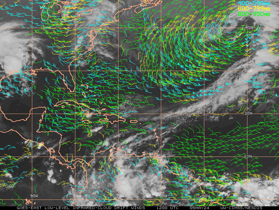
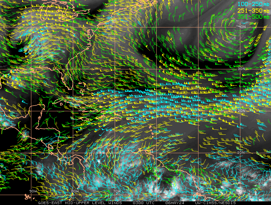
Current Wind Direction
Lower Level Winds
 Upper Level Winds
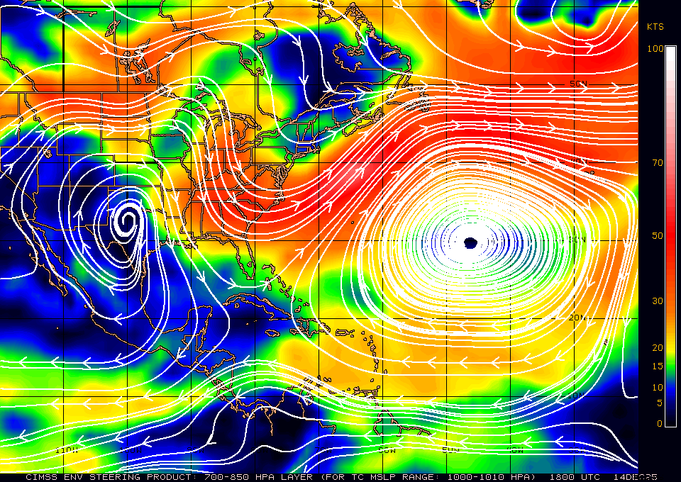
 Layer mean wind steering maps will give you vital information on the direction Tropical Cyclones are possibly going to take based on their current intensity. Check out the current Atlantic mean wind steering maps below...
These wind analyses depict the environmental flow in various oceanic basins for selected tropospheric layer-means. Based on previous studies, the depth of this layer is correlated with the TC steering layer, and generally increases with increasing TC intensity. These layer-mean steering fields are created by mass-weighting mandatory-level, high-resolution wind analyses derived locally at UW-CIMSS using a three-dimensional recursive filter technique. These analyses are strongly influenced by high-density, multispectral satellite-derived wind information. Data from NWP global models provide background field information for each analysis run. Source: CIMSS
So just to give you an idea a very weak Tropical Cyclone will follow the flow steered by the lower level winds (Example 700-850mb) and a very strong Tropical Cyclone would follow the flow steered by the higher level winds (Example 200-850mb). Of course mean layer wind steering is not the only factor in forecasting Tropical Cyclone direction.
700-850mb
TC MSLP/Vmax: >1000mb/<45kts


 DONATE