
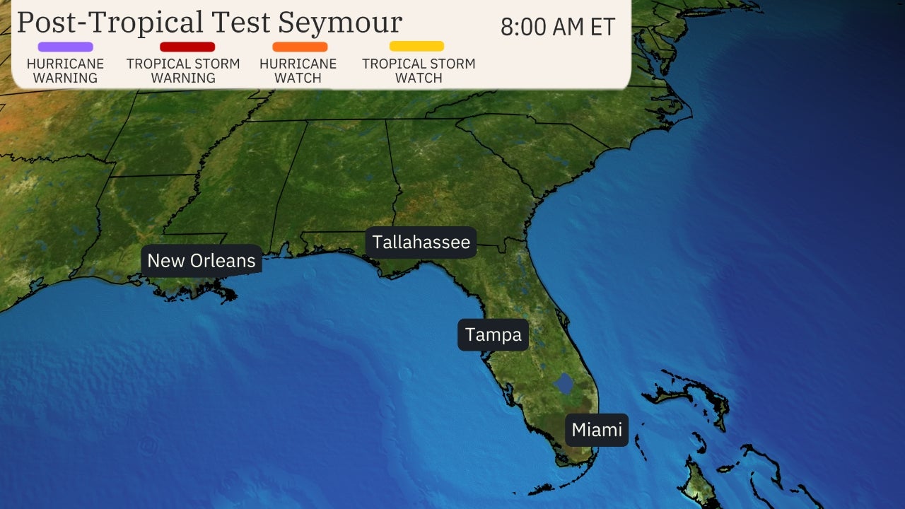
Projected Path with Watches and Warnings

Zoomed In Watches and Warnings
Winfield of Beta

Additional Projected Path Swath


Tropical Storm Force Wind Probs

Most Likely Arrival Time of Tropical Storm Force Winds

Most Reasonable Arrival Time of Tropical Storm Force Winds

Hurricane Force Wind Probabilities

Tropical Storm Force Wind Probabilities

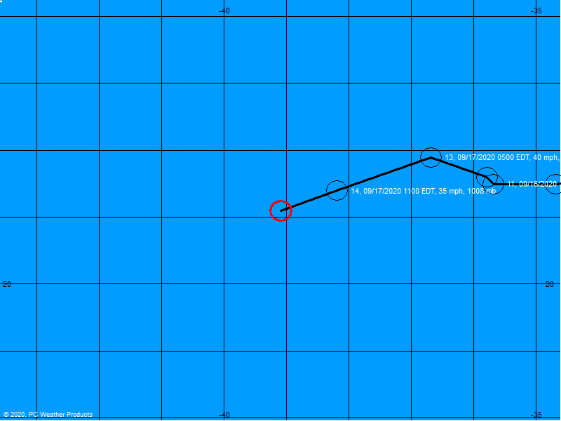
Past Track History


NOAA NESDIS Floaters


Storm Surge Forecast


Rainfall Forecast


Additional Rainfall Forecast

Flash Flood Potential


Surface Wind Field

Cumulative Wind History

Top Analog Tracks

Windfield
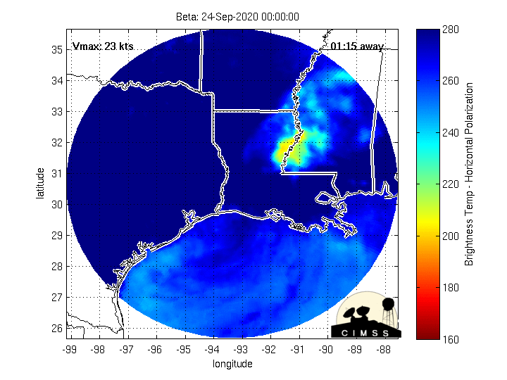
Microwave Imagery
Beta Key Messages

Still Image Radar and Winds

Radar Loops Near Beta


LIVE Power Outage Map

SPC Watches and Warnings

Intensity Forecasts

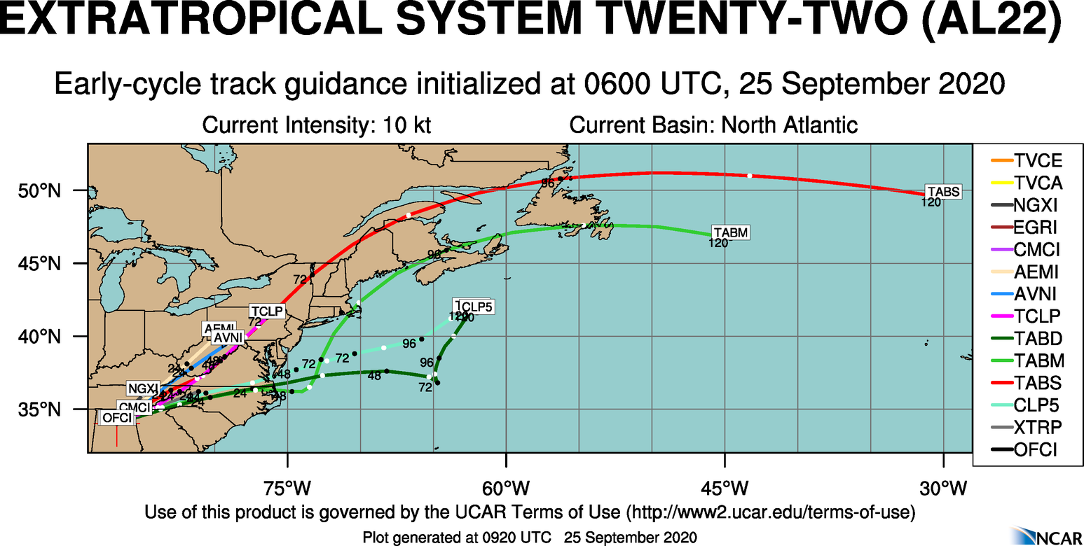
Model Tracks


GFS / Canadian Ensemble Tracks

EURO Ensemble Tracks
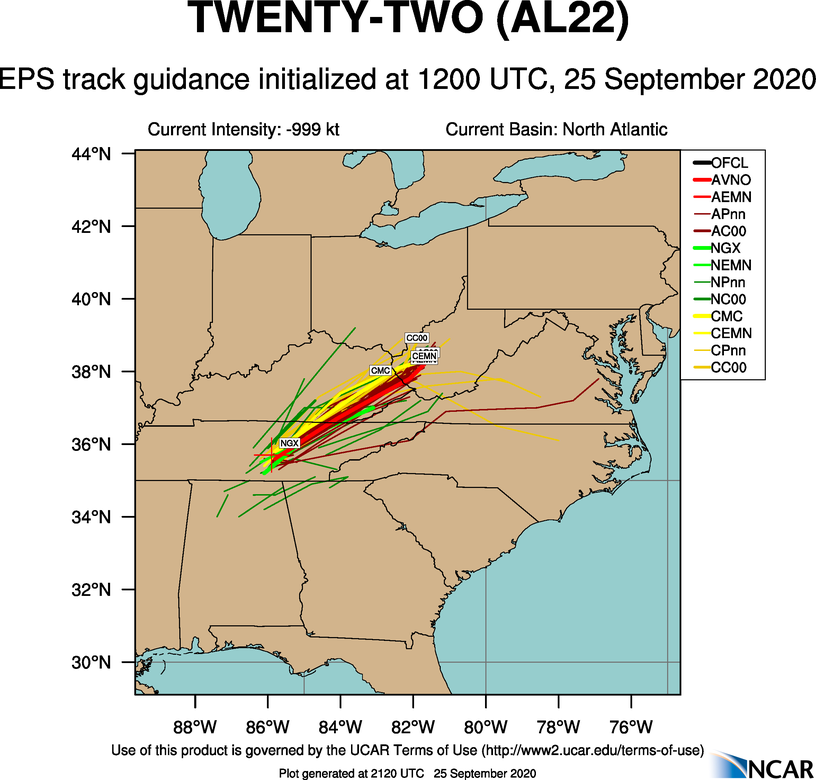
EPS Ensemble Tracks
2 Day Tropical Weather Outlook
5 Day Tropical Weather Outlook