![[Map of 1950-2017 CONUS Hurricane Strikes]](http://www.nhc.noaa.gov/climo/images/conus_strikes.jpg)


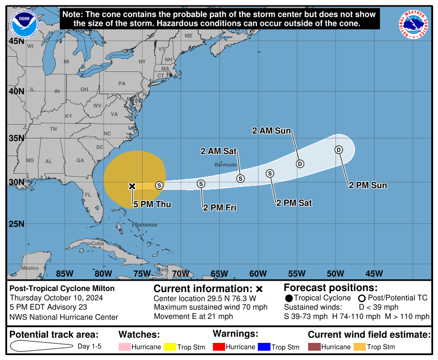
NHC Projected Path
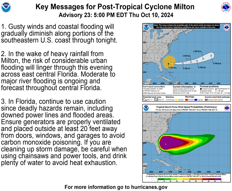
 Key Messages
 Zoomed In Watches and Warnings

Additional Projected Path Swath
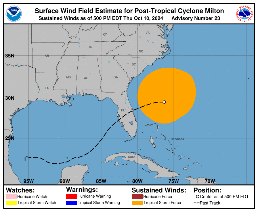
 Windfield
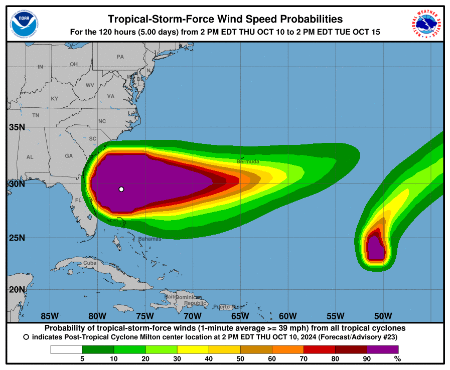
 Tropical Storm Force Wind Probs

Key Messages
Zoomed In Watches and Warnings
Additional Projected Path Swath
Windfield
Tropical Storm Force Wind Probs
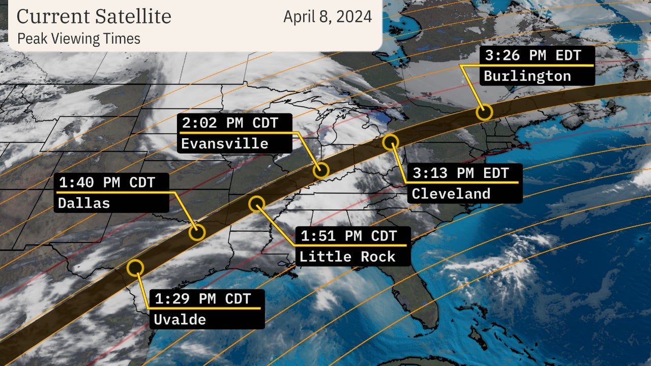
Current Satellite of Storm
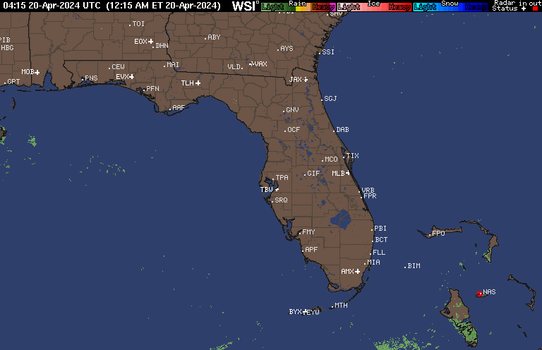
Current Radar of Storm

Current Wind Field

Most Likely Arrival Time of Tropical Storm Force Winds
 Most Reasonable Arrival Time of Tropical Storm Force Winds
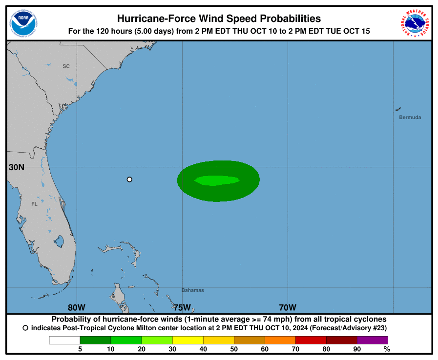
 Hurricane Force Wind Probabilities
 Tropical Storm Force Wind Probabilities
Most Reasonable Arrival Time of Tropical Storm Force Winds
Hurricane Force Wind Probabilities
Tropical Storm Force Wind Probabilities
Microwave Imagery

NOAA NESDIS Floaters


Other Floaters:
WeatherNerds - NRL Floaters - CyclonicWx - RAMMB Sat - RAMMB Model Data - RAMMB Wind Products
Other Floaters:
WeatherNerds - NRL Floaters - CyclonicWx - RAMMB Sat - RAMMB Model Data - RAMMB Wind Products
Peak Wind Threats

Power Outage Forecasts

Surge Forecast


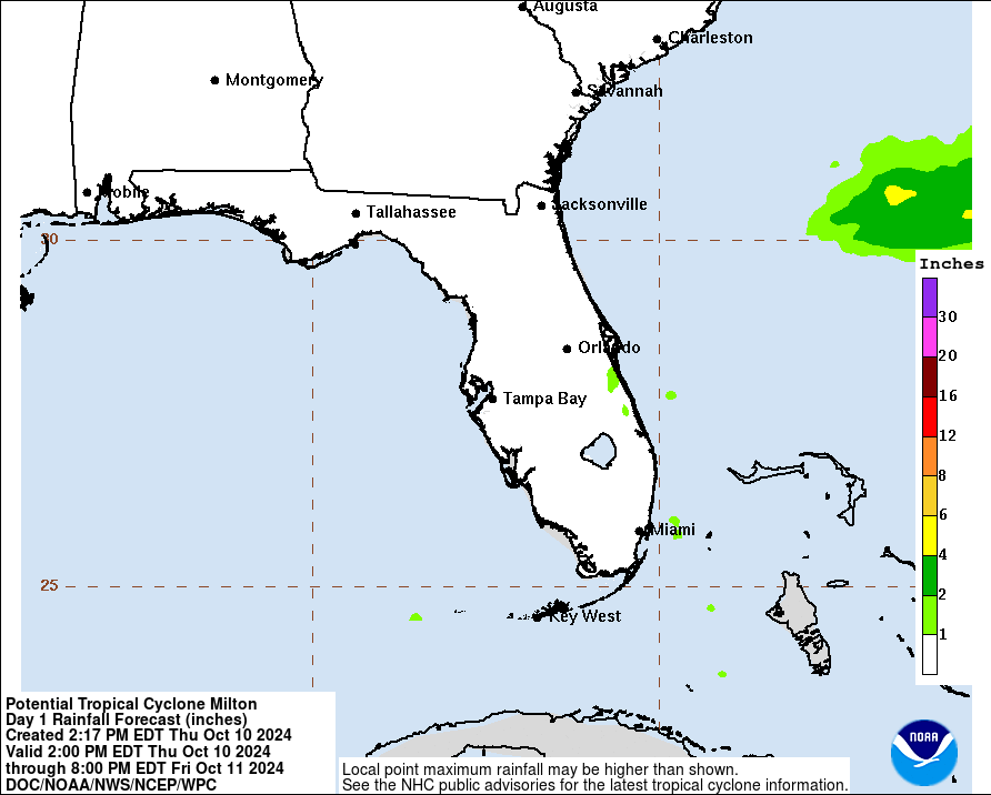
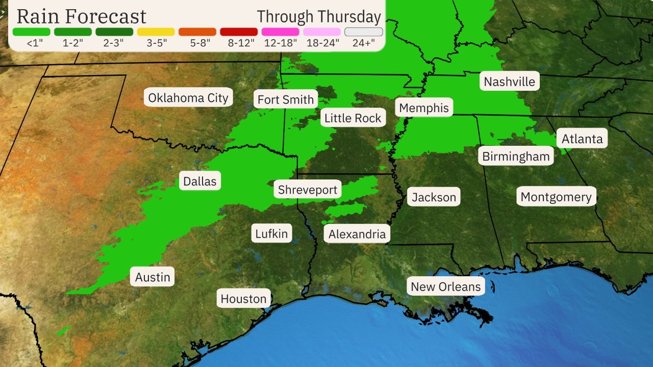
Rainfall Forecast
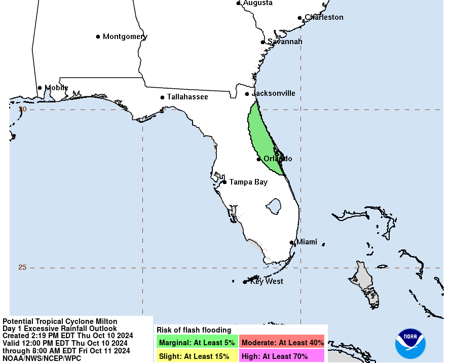
Flash Flood Potential
Sea Surface Temps Around Storm

Windshear Around Storm

Ocean Heat Content (OHC) Around Storm
Saharan Dust Layer (SAL) around Storm

Windshear Around Storm
Ocean Heat Content (OHC) Around Storm
Saharan Dust Layer (SAL) around Storm


LIVE Power Outage Map
SPC Watches and Warnings

SPC Watches and Warnings
Average Days For System To Reach U.S.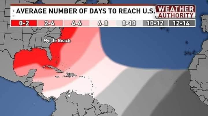
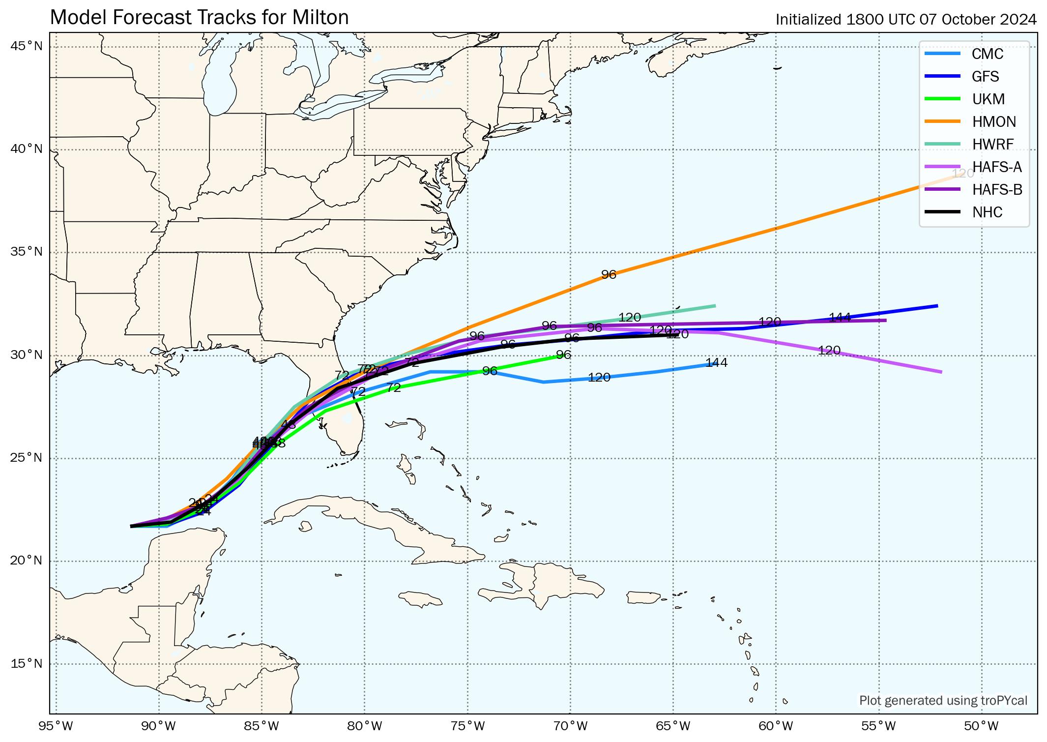
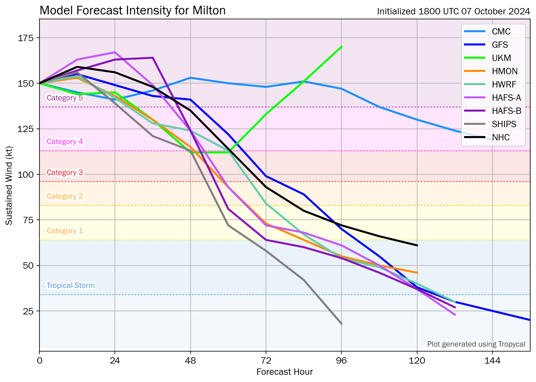
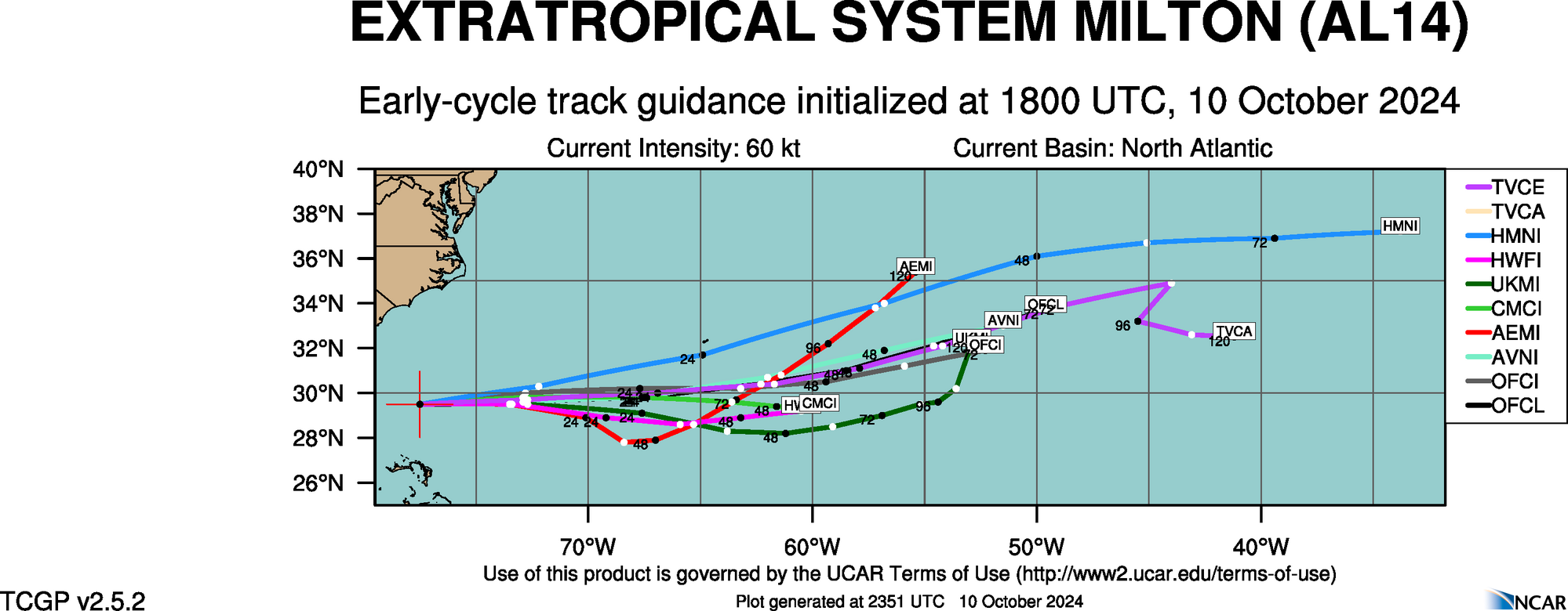
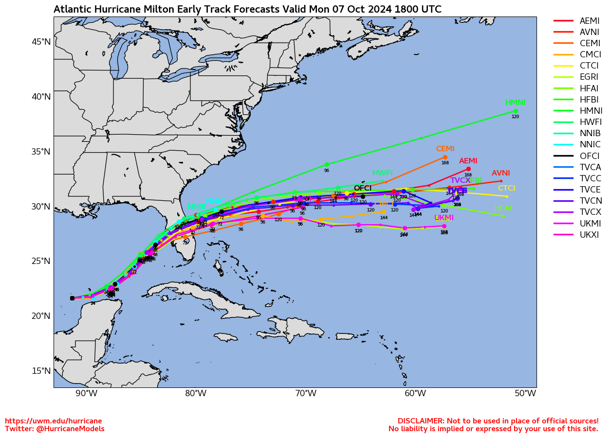
Other Model Tracks
 EURO Ensemble Tracks
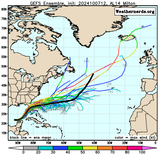
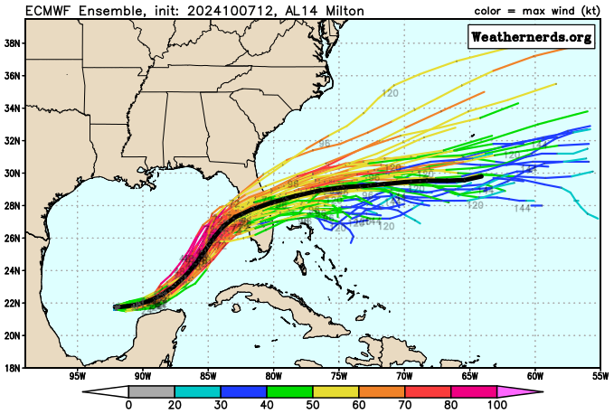 GFS Ensemble Tracks
EURO Ensemble Tracks
GFS Ensemble Tracks
2 Day Tropical Weather Outlook
7 Day Tropical Weather Outlook