Page Navigation: Atlantic Tropical Outlook / Tropical Discussion / Active Tropical Systems
Scheduled Recon Flight Plans / Marine Weather Discussion / Tropical Monthly Summary
2 Day Graphical Tropical Weather Outlook

7 Day Graphical Tropical Weather Outlook

Atlantic Tropical Weather Outlook
- Wed, 24 Apr 2024 20:08:01 +0000: Atlantic Tropical Weather Outlook - Atlantic Tropical Weather Outlook
000
ABNT20 KNHC 242007
TWOAT
Special Tropical Weather Outlook
NWS National Hurricane Center Miami FL
410 PM EDT Wed Apr 24 2024
For the North Atlantic...Caribbean Sea and the Gulf of Mexico:
East-Central Subtropical Atlantic:
An area of low pressure located about 900 miles northwest of the
Cabo Verde Islands has been producing a small but persistent area
of showers and thunderstorms to the east of its center since this
morning. However, the low is forecast to move southwestward at 10
to 15 mph into an area of stronger upper-level winds tonight and
tomorrow, and additional development is not expected.
No additional Special Tropical Weather Outlooks are scheduled for
this system unless conditions warrant. Regularly scheduled
Tropical Weather Outlooks will resume on May 15, 2024, and Special
Tropical Weather Outlooks will be issued as necessary during the
remainder of the off-season.
* Formation chance through 48 hours...low...10 percent.
* Formation chance through 7 days...low...10 percent.
$$
Forecaster Berg/Brown
Tropical Weather Discussion
- Mon, 29 Apr 2024 10:25:24 +0000: NHC Atlantic Tropical Weather Discussion - NHC Tropical Weather Discussion (Atlantic)
893
AXNT20 KNHC 291025
TWDAT
Tropical Weather Discussion
NWS National Hurricane Center Miami FL
1205 UTC Mon Apr 29 2024
Tropical Weather Discussion for North America, Central America
Gulf of Mexico, Caribbean Sea, northern sections of South
America, and Atlantic Ocean to the African coast from the
Equator to 31N. The following information is based on satellite
imagery, weather observations, radar and meteorological analysis.
Based on 0600 UTC surface analysis and satellite imagery through
1015 UTC.
...MONSOON TROUGH/ITCZ...
The monsoon trough reaches the Atlantic through the coast of Sierra
Leone near 08N13W and continues southwestward to 06N16W. The ITCZ
extends from 06N16W to 00N27W to 06N41W to 04N51W. Numerous
moderate to isolated strong convection is observed south of 07N
and between 16W and 39W.
GULF OF MEXICO...
The strong thunderstorms affecting eastern Texas and Louisiana
are also impacting the nearshore waters of the NW Gulf of Mexico.
A subtropical ridge over the western Atlantic extends across the
Gulf waters, supporting moderate to fresh easterly winds and
moderate seas.
For the forecast, the high pressure system will weaken over the
next few days, resulting in diminishing winds and decreasing seas
across the basin. Elsewhere, winds will pulse to fresh to strong
speeds near the Yucatan Peninsula and south-central Gulf each
evening through the forecast period.
CARIBBEAN SEA...
The subtropical ridge north of the Greater Antilles continues to
sustain fresh to strong easterly winds fresh to locally strong
easterly trade winds south of Hispaniola, Windward Passage and
Gulf of Honduras. Seas in these waters are 6-8 ft. Moderate to
locally fresh easterly breezes and 4-6 ft are found in the
remainder of the central and NW Caribbean waters. Elsewhere,
moderate or weaker winds and slight to moderate seas prevail.
Pockets of low-level moisture traveling across the Caribbean are
producing isolated, weak showers.
For the forecast, the aforementioned ridge will gradually weaken
over the next few days. Fresh to locally strong easterly winds in
the Gulf of Honduras, Windward Passage and offshore southern
Hispaniola will diminish midweek. Otherwise, moderate to locally
fresh easterly winds will prevail. Northerly swell will push rough
seas through the passages in the NE Caribbean through the middle
of the week.
ATLANTIC OCEAN...
A cold front extends from 31N43W to 21N59W. A pre-frontal trough
are analyzed from 25N45W to 17N49W. A few showers are found east
of the trough. Fresh to strong southerly winds are found ahead of
the front to 35W and north of 28N. Seas in these waters are 8-9
ft. Fresh to strong westerly winds and seas of 10-13 ft are
present north of 29N and between 51W and 62W. Moderate to fresh
easterly winds are noted south of 26N and west of the front. The
remainder of the SW North Atlantic is under the influence of a
broad subtropical ridge centered between the SE US and Bermuda.
The rest of the central and eastern Atlantic is dominated by a
1029 mb high pressure system located over the Azores. The pressure
gradient between this ridge and lower pressures in western Africa
support fresh to strong NE-E winds north of 12N and east of 35W.
Seas in the area described are 6-9 ft. Elsewhere, moderate or
weaker winds and moderate seas are prevalent.
For the forecast west of 55W, the aforementioned front will shift
eastward and weaken over the far southeastern waters through
early Tue. Fresh to strong W winds will prevail N of 28N and east
of 65W, decreasing Wed. Seas will peak near 14 ft this afternoon.
Also, fresh to locally strong winds will cover the waters S of 22N
and W of 70W through late today, especially at the entrance of
the Windward Passage. More tranquil marine conditions are expected
afterwards as high pressure becomes centered over the NW waters.
$$
Delgado
Active Tropical Systems
- Wed, 24 Apr 2024 01:42:49 +0000: The Atlantic hurricane season runs from June 1st through November 30th. - NHC Atlantic
The Atlantic hurricane season runs from June 1st through November 30th.
Scheduled Reconnaissance Flight Plans
- Mon, 01 Apr 2024 14:54:44 +0000: Weather Reconnaissance Flights Plan of the Day - Weather Reconnaissance Flights Plan of the Day
 000
 NOUS42 KNHC 011454
 REPRPD
 WEATHER RECONNAISSANCE FLIGHTS
 CARCAH, NATIONAL HURRICANE CENTER, MIAMI, FL.
 1100 AM EDT MON 01 APRIL 2024
 SUBJECT: WINTER SEASON PLAN OF THE DAY (WSPOD)
          VALID 02/1100Z TO 03/1100Z APRIL 2024
          WSPOD NUMBER.....23-123

 I.  ATLANTIC REQUIREMENTS
     1. NEGATIVE RECONNAISSANCE REQUIREMENTS.
     2. OUTLOOK FOR SUCCEEDING DAY.....NEGATIVE.

 NOTE:  THIS IS THE LAST WSPOD OF THE SEASON UNLESS CONDITIONS
        DICTATE OTHERWISE.

 $$
 SEF

 NNNN
Marine Weather Discussion
- Mon, 17 May 2021 15:22:40 +0000: NHC Marine Weather Discussion - NHC Marine Weather Discussion
000
AGXX40 KNHC 171522
MIMATS
Marine Weather Discussion
NWS National Hurricane Center Miami FL
1122 AM EDT Mon May 17 2021
Marine Weather Discussion for the Gulf of Mexico, Caribbean Sea,
and Tropical North Atlantic from 07N to 19N between 55W and 64W
and the Southwest North Atlantic including the Bahamas
This is the last Marine Weather Discussion issued by the National
Hurricane Center. For marine information, please see the Tropical
Weather Discussion at: hurricanes.gov.
...GULF OF MEXICO...
High pressure along the middle Atlantic coasts extending SW to
the NE Gulf will remain generally stationary throughout the
week. This will support moderate to fresh E to SE winds over the
basin through Tue. Winds will increase to fresh to strong late
Tue through Fri as low pressure deepens across the Southern
Plains.
...CARIBBEAN SEA AND TROPICAL N ATLANTIC FROM 07N TO 19N BETWEEN
55W AND 64W...
A ridge NE of the Caribbean Sea will shift eastward and weaken,
diminishing winds and seas modestly through Wed. Trade winds
will increase basin wide Wed night through Fri night as high
pressure builds across the western Atlantic.
...SW N ATLANTIC INCLUDING THE BAHAMAS...
A weakening frontal boundary from 25N65W to the central Bahamas
will drift SE and dissipate through late Tue. Its remnants will
drift N along 23N-24N. The pressure gradient between high
pressure off of Hatteras and the frontal boundary will support
an area of fresh to strong easterly winds N of 23N and W of 68W
with seas to 11 ft E of the Bahamas late Tue through Fri.
$$
.WARNINGS...Any changes impacting coastal NWS offices will be
coordinated through AWIPS II Collaboration Chat, or by
telephone:
.GULF OF MEXICO...
None.
.CARIBBEAN SEA AND TROPICAL N ATLANTIC FROM 07N TO 19N BETWEEN
55W AND 64W...
None.
.SW N ATLANTIC INCLUDING THE BAHAMAS...
None.
$$
*For detailed zone descriptions, please visit:
http://www.nhc.noaa.gov/abouttafbprod.shtml#OWF
Note: gridded marine forecasts are available in the National
Digital Forecast Database (NDFD) at:
http://www.nhc.noaa.gov/marine/grids.php
For additional information, please visit:
http://www.nhc.noaa.gov/marine
$$
.Forecaster GR. National Hurricane Center.
Atlantic Tropical Monthly Summary
- Fri, 01 Dec 2023 12:58:54 +0000: Atlantic - Atlantic
000
ABNT30 KNHC 011258
TWSAT
Monthly Tropical Weather Summary
NWS National Hurricane Center Miami FL
800 AM EST Fri Dec 1 2023
For the North Atlantic...Caribbean Sea and the Gulf of Mexico:
No tropical cyclones formed in the Atlantic basin in the month of
November. Based on a 30-year climatology (1991-2020), a tropical
storm forms in November once every year or two, and a hurricane
forms once every two years. A disturbance (Potential Tropical
Cyclone Twenty-Two) caused heavy rains and flooding across portions
of Jamaica, eastern Cuba, and Hispaniola during the middle part of
the month, but the system did not become a tropical cyclone.
Overall, the 2023 Atlantic hurricane season had above-normal
activity in terms of the number of named storms but a normal amount
of activity in terms of the number of hurricanes and major
hurricanes. In 2023, 20 storms of at least tropical storm strength
formed, of which 7 became hurricanes and 3 became major hurricanes
(category 3 or higher on the Saffir-Simpson Hurricane Wind Scale).
This compares to the long-term (1991-2020) averages of 14 named
storms, 7 hurricanes, and 3 major hurricanes. In terms of
Accumulated Cyclone Energy (ACE), which measures the strength and
duration of tropical storms and hurricanes, activity in the basin
in 2023 was about 20 percent above average compared to the long-term
(1991-2020) mean.
Reports on individual cyclones, when completed, are available at the
National Hurricane Center website at
www.hurricanes.gov/data/tcr/index.php?season=2023&basin=atl
Summary Table
Name Dates Max Wind (mph)
-----------------------------------------------------------
Unnamed STS 16-17 Jan 70*
TS Arlene 1-3 Jun 40*
TS Bret 19-24 Jun 70*
TS Cindy 22-26 Jun 60*
H Don 14-24 Jul 75*
TS Emily 20-21 Aug 50*
MH Franklin 20 Aug- 1 Sep 150
TS Gert 19- 4 Sep 60*
TS Harold 21-23 Aug 50
MH Idalia 26-31 Aug 130
TS Jose 29 Aug- 1 Sep 60
TS Katia 1- 4 Sep 60
MH Lee 5-16 Sep 165
H Margot 7-17 Sep 90
H Nigel 15-22 Sep 100
TS Ophelia 22-24 Sep 70
TS Philippe 23 Sep- 6 Oct 50
TS Rina 28 Sep- 1 Oct 50*
TS Sean 11-15 Oct 45
H Tammy 18-29 Oct 105
TD Twenty-One 23-24 Oct 30
-----------------------------------------------------------
* Denotes a storm for which the post-storm analysis is complete.
$$
Hurricane Specialist Unit

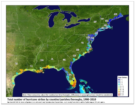
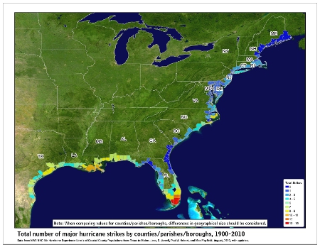
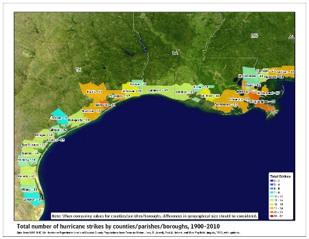
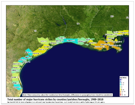
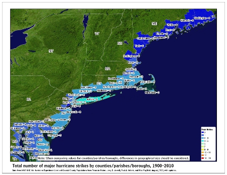
![[Map of 1950-2017 CONUS Hurricane Strikes]](http://www.nhc.noaa.gov/climo/images/conus_strikes_sm.jpg)

Facebook Comments