200 Visitors Tracking The Tropics!

Track The Tropics is the #1 source to track the tropics 24/7! Since 2013 the main goal of the site is to bring all of the important links and graphics to ONE PLACE so you can keep up to date on any threats to land during the Atlantic Hurricane Season! Hurricane Season 2026 in the Atlantic starts on June 1st and ends on November 30th. Do you love Spaghetti Models? Well you've come to the right place!! Remember when you're preparing for a storm: Run from the water; hide from the wind!
Tropical Atlantic Weather Resources
- NOAA National Hurricane Center
- International Meteorology Database
- FSU Tropical Cyclone Track Probabilities
- Brian McNoldy Atlantic Headquarters
- Brian McNoldy Tropical Satellite Sectors
- Brian McNoldy Infrared Hovmoller
- Brian McNoldy Past TC Radar Loops
- Weather Nerds TC Guidance
- Twister Data Model Guidance
- NOAA Tropical Cyclone Tracks
- Albany GFS/ EURO Models/ Ensembles
- Albany Tropical Cyclone Guidance
- Albany Tropical Atlantic Model Maps
- Pivotal Weather Model Guidance
- Weather Online Model Guidance
- UKMet Model Guidance/ Analysis/ Sat
- ECMWF (EURO) Model Guidance
- FSU Tropical Model Outputs
- FSU Tropical Cyclone Genesis
- Penn State Tropical E-Wall
- NOAA HFIP Ruc Models
- Navy NRL TC Page
- College of DuPage Model Guidance
- WXCharts Model Guidance
- NOAA NHC Analysis Tools
- NOAA NHC ATCF Directory
- NOAA NCEP/EMC Cyclogenesis Tracking
- NOAA NCEP/EMC HWRF Model
- NOAA HFIP Model Products
- University of Miami Ocean Heat
- COLA Max Potential Hurricane Intensity
- Colorado State RAMMB TC Tracking
- Colorado State RAMMB Floaters
- Colorado State RAMMB GOES-16 Viewer
- NOAA NESDIS GOES Satellite
- ASCAT Ocean Surface Winds METOP-A
- ASCAT Ocean Surface Winds METOP-B
- Michael Ventrice Waves / MJO Maps
- TropicalAtlantic.com Analysis / Recon
- NCAR/RAL Tropical Cyclone Guidance
- CyclonicWX Tropical Resources
Historic Louisiana Storms By Month
January
June
July
August
September
October
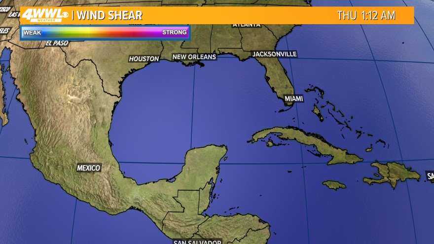
Atlantic Wind Shear
Wind shear is often the most critical factor controlling hurricane formation and destruction. In general, wind shear refers to any change in wind speed or direction along a straight line. In the case of hurricanes it is important primarily in the vertical direction--from the surface to the top of the troposphere. The troposphere is the region of the atmosphere that our active weather is confined to, and extends up to about 40,000 feet altitude (a pressure of about 200 mb) in the tropics in summer. Hurricanes fill the entire vertical extent of the troposphere, and are steered by the average wind through this layer. When one hears the phrase, "wind shear is 20 knots over the hurricane", this typically refers to the difference in wind speed between 200 mb (the top of the troposphere, 40,000 feet altitude) and a layer where a pressure of 850 mb is found--about 5,000 feet above the surface. This wind shear is computed over a large area--a circle of 700 miles in diameter centered on the hurricane is one technique used. This 200-850 mb wind shear is a crude measure of the actual wind shear a storm experiences, since only changes in wind speed--not wind direction--are considered. Furthermore, the computed shear does not consider any smaller scale changes that may occur within this large volume of the atmosphere. For example, it is common to find a strong jet of wind at about 600 mb blowing along the edge of the Saharan Air Layer (SAL)--that area of dry, dusty air that frequently lies to the north of developing tropical cyclones in the mid-Atlantic. This jet will create significant wind shear that will not show up on the standard 200-850 mb wind shear plots. Since upper-air measurements are very sparse over the open ocean, shear that is invisible on 200-850 mb wind shear analysis charts will often unexpectedly kill or weaken a developing tropical cyclone.
Tropical cyclones are heat engines powered by the release of latent heat when water vapor condenses into liquid water. Shear hurts tropical cyclones by removing the heat and moisture they need from the area near their center. Shear will also distort the shape of a hurricane by shearing it (blowing the top away from the lower portion), so that the vortex is tilted. A tilted vortex is usually a less efficient heat engine--the delicate balance of inflowing low-level winds and outflowing upper-level winds that ventilate the storm gets disrupted. Dr. Bill Gray of Colorado State University was one of the first scientists to study the effect of winds shear on hurricane formation. In his classic 1968 paper, "Global View of the Origin of Tropical Disturbances and Storms" --- Source: WUG and Wiki